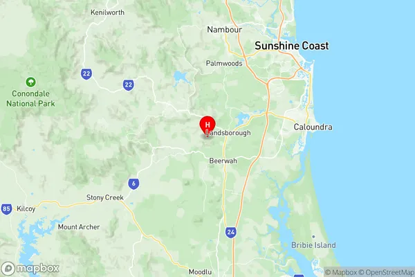
Landsborough Suburbs & Region, Landsborough Map & Postcodes
Landsborough Suburbs & Region, Landsborough Map & Postcodes in Landsborough, Sunshine Coast Hinterland, Sunshine Coast, QLD, AU
Landsborough Region
Region Name
Landsborough (QLD, AU)Landsborough Area
134.57 square kilometers (134.57 ㎢)Postal Codes
4550, and 4553 (In total, there are 2 postcodes in Landsborough.)Landsborough Introduction
Landsborough is a suburb in the City of Sunshine Coast, Queensland, Australia. It is located in the hinterland of the Sunshine Coast and is approximately 50 kilometers north of Brisbane. Landsborough is known for its beautiful beaches, lush gardens, and peaceful atmosphere. It is a popular destination for tourists and locals alike and is home to a number of popular attractions, including the Landsborough Historical Museum, the Landsborough Botanic Gardens, and the Landsborough Aquatic Centre.Australia State
City or Big Region
Greater Capital City
Rest of Qld (3RQLD)District or Regional Area
Suburb Name
Landsborough Region Map

Landsborough Postcodes / Zip Codes
Landsborough Suburbs
Landsborough full address
Landsborough, Sunshine Coast Hinterland, Sunshine Coast, Queensland, QLD, Australia, SaCode: 316061442Country
Landsborough, Sunshine Coast Hinterland, Sunshine Coast, Queensland, QLD, Australia, SaCode: 316061442
Landsborough Suburbs & Region, Landsborough Map & Postcodes has 0 areas or regions above, and there are 6 Landsborough suburbs below. The sa2code for the Landsborough region is 316061442. Its latitude and longitude coordinates are -26.8187,152.926. Landsborough area belongs to Australia's greater capital city Rest of Qld.
Landsborough Suburbs & Localities
1. Diamond Valley
2. Mooloolah Valley
3. Glenview
4. Mount Mellum
5. Mooloolah
6. Palmview
