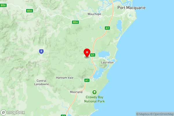
Laurieton Bonny Hills Suburbs & Region, Laurieton Bonny Hills Map & Postcodes
Laurieton Bonny Hills Suburbs & Region, Laurieton Bonny Hills Map & Postcodes in Laurieton Bonny Hills, Sunshine Coast Hinterland, Sunshine Coast, NSW, AU
Laurieton Bonny Hills Region
Region Name
Laurieton Bonny Hills (NSW, AU)Laurieton Bonny Hills Area
524.91 square kilometers (524.91 ㎢)Postal Codes
2439, 2443, 2445, and 4551 (In total, there are 4 postcodes in Laurieton Bonny Hills.)Laurieton Bonny Hills Introduction
Laurieton Bonny Hills is a locality in the Sunshine Coast Region, Queensland, Australia. It is part of the Caloundra local government area. At the 2011 Australian census, Laurieton Bonny Hills had a population of 2,558. The locality is named after the Bonny Hills, which are a range of hills to the north of the town. The hills were named by Captain James Cook on his third voyage to Australia in 1770. The town was originally called "Coomera" but was renamed "Laurieton" in 1912 after the wife of the postmaster, John Laurieton. The town is a popular tourist destination and is known for its beaches, parks, and golf courses. It is also home to a number of wineries and breweries. Laurieton Bonny Hills is located about 100 kilometers north of Brisbane and 25 kilometers south of Caloundra.Australia State
City or Big Region
Greater Capital City
Rest of NSW (1RNSW)District or Regional Area
Suburb Name
Laurieton Bonny Hills Region Map

Laurieton Bonny Hills Postcodes / Zip Codes
Laurieton Bonny Hills Suburbs
Laurieton Bonny Hills full address
Laurieton Bonny Hills, Sunshine Coast Hinterland, Sunshine Coast, New South Wales, NSW, Australia, SaCode: 108041162Country
Laurieton Bonny Hills, Sunshine Coast Hinterland, Sunshine Coast, New South Wales, NSW, Australia, SaCode: 108041162
Laurieton Bonny Hills Suburbs & Region, Laurieton Bonny Hills Map & Postcodes has 0 areas or regions above, and there are 31 Laurieton Bonny Hills suburbs below. The sa2code for the Laurieton Bonny Hills region is 108041162. Its latitude and longitude coordinates are -31.6333,152.7. Laurieton Bonny Hills area belongs to Australia's greater capital city Rest of NSW.
Laurieton Bonny Hills Suburbs & Localities
1. Batar Creek
2. Black Creek
3. Bobs Creek
4. Herons Creek
5. Kendall
6. Kerewong
8. Logans Crossing
9. Lorne
10. Rossglen
11. Swans Crossing
12. Upsalls Creek
13. Bobs Creek
14. Camden Head
15. Crowdy Bay
16. Deauville
17. Diamond Head
18. Dicks Hill
19. Dunbogan
20. Herons Creek
21. Lakewood
22. Laurieton
23. Middle Brother
24. North Brother
25. North Haven
26. West Haven
27. Bonny Hills
28. Grants Beach
29. Jolly Nose
30. Lake Cathie
31. Diamond Head
