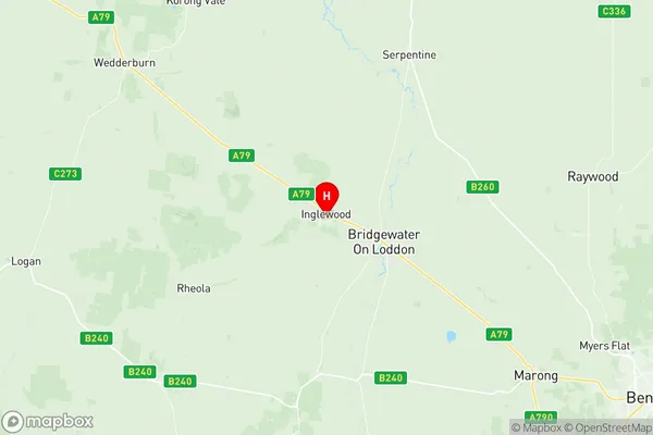
Loddon Suburbs & Region, Loddon Map & Postcodes
Loddon Suburbs & Region, Loddon Map & Postcodes in Loddon, Campaspe, Shepparton, VIC, AU
Loddon Region
Region Name
Loddon (VIC, AU)Loddon Area
6193 square kilometers (6,193 ㎢)Postal Codes
3463, 3472, 3475, 3478, from 3516 to 3518, 3520, 3525, 3537, 3551, from 3570 to 3573, 3575, and 3576 (In total, there are 17 postcodes in Loddon.)Loddon Introduction
Loddon is a locality in the Shepparton region of Victoria, Australia. It is located on the Loddon River, and the town is surrounded by farmland. The Loddon River flows into the Murray River, and the town is a popular stopping point for tourists traveling along the Murray River. The town has a population of around 1,500 people and is known for its historic buildings, including the Loddon Mill, which is one of the oldest flour mills in Australia. The town also has a community hall, a swimming pool, and a golf course.Australia State
City or Big Region
Greater Capital City
Rest of Vic. (2RVIC)District or Regional Area
Suburb Name
Loddon Region Map

Loddon Postcodes / Zip Codes
Loddon Suburbs
Loddon full address
Loddon, Campaspe, Shepparton, Victoria, VIC, Australia, SaCode: 202031033Country
Loddon, Campaspe, Shepparton, Victoria, VIC, Australia, SaCode: 202031033
Loddon Suburbs & Region, Loddon Map & Postcodes has 0 areas or regions above, and there are 82 Loddon suburbs below. The sa2code for the Loddon region is 202031033. Its latitude and longitude coordinates are -36.5764,143.869. Loddon area belongs to Australia's greater capital city Rest of Vic..
Loddon Suburbs & Localities
1. Burkes Flat
2. Mcintyre
3. Logan
4. Berrimal West
5. Woodstock West
6. Laanecoorie
7. Cochranes Creek
8. Jarklin
9. Fentons Creek
10. Fiery Flat
11. Kurraca
12. Skinners Flat
13. Wedderburn
14. Korong Vale
15. South Kinypanial
16. Barraport
17. Canary Island
18. Murphys Creek
19. Bridgewater North
20. Glenalbyn
21. Powlett Plains
22. Rheola
23. Salisbury West
24. Fernihurst
25. Wedderburn Junction
26. Buckrabanyule
27. Lake Marmal
28. Boort
29. Catumnal
30. Minmindie
31. Yando
32. Arnold
33. Arnold West
34. Waanyarra
35. Pompapiel
36. Tandarra
37. Mitiamo
38. Bald Rock
39. Jungaburra
40. Loddon Vale
41. Pyramid Hill
42. Sylvaterre
43. Yarrawalla
44. Auchmore
45. Prairie
46. Mologa
47. Bridgewater On Loddon
48. Derby
49. Bears Lagoon
50. Inglewood
51. Kingower
52. Kurting
53. Borung
54. Kurraca West
55. Richmond Plains
56. Wehla
57. Kinypanial
58. Wychitella
59. Barraport West
60. Gredgwin
61. Bridgewater
62. Yarraberb
63. Brenanah
64. Bullabul
65. Serpentine
66. Berrimal
67. Mysia
68. Woolshed Flat
69. Terrappee
70. Wychitella North
71. Leaghur
72. Llanelly
73. Newbridge
74. Tarnagulla
75. Woodstock On Loddon
76. Dingee
77. Calivil
78. Gladfield
79. Terrick Terrick
80. Yallook
81. Mincha
82. Durham Ox
