Sutherland Menai Heathcote Suburbs & Region, Sutherland Menai Heathcote Map & Postcodes
Sutherland Menai Heathcote Suburbs & Region, Sutherland Menai Heathcote Map & Postcodes in Sutherland Menai Heathcote, Sydney Sutherland, NSW, AU
Sutherland Menai Heathcote Region
Region Name
Sutherland Menai Heathcote (NSW, AU)Sutherland Menai Heathcote Area
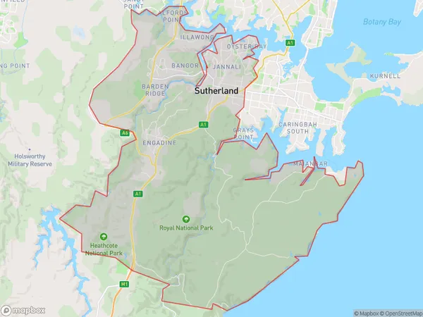
240.25 square kilometers (240.25 ㎢)Postal Codes
1499, from 2224 to 2227, 2230, and from 2232 to 2234 (In total, there are 9 postcodes in Sutherland Menai Heathcote.)Sutherland Menai Heathcote Suburb Area Map (Polygon)
Sutherland Menai Heathcote Introduction
Sutherland Menai Heathcote is a suburb in southern Sydney, in the state of New South Wales, Australia. It is located 36 kilometers south of the Sydney central business district and is part of the Sutherland Shire. The suburb is named after the Menai River, which flows through it, and Heathcote, a nearby area. Sutherland Menai Heathcote is a primarily residential area with a mix of single-family homes, apartments, and townhouses. The suburb has a variety of shops, cafes, and restaurants, as well as a community center and a library. The area is known for its natural beauty, with several parks and reserves, including the Menai Nature Reserve and the Heathcote National Park. Sutherland Menai Heathcote is well-connected to the rest of Sydney, with easy access to the M4 motorway and the South Coast railway line. The suburb is also home to several major hospitals, including the Prince of Wales Hospital and the St George Hospital.Australia State
City or Big Region
District or Regional Area
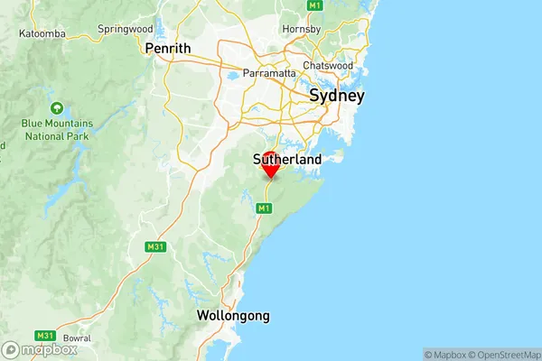
Sutherland Menai Heathcote Region Map
Sutherland Menai Heathcote Postcodes / Zip Codes
Sutherland Menai Heathcote Suburbs
Illawong Alfords Point
Menai Lucas Heights Woronora
Oyster Bay Como Jannali
Sutherland Menai Heathcote full address
Sutherland Menai Heathcote, Sydney Sutherland, New South Wales, NSW, Australia, SaCode: 12802Country
Sutherland Menai Heathcote, Sydney Sutherland, New South Wales, NSW, Australia, SaCode: 12802
Sutherland Menai Heathcote Suburbs & Region, Sutherland Menai Heathcote Map & Postcodes has 10 areas or regions above, and there are 46 Sutherland Menai Heathcote suburbs below. The sa3code for the Sutherland Menai Heathcote region is 12802. Its latitude and longitude coordinates are -34.0851,151.008.
Sutherland Menai Heathcote Suburbs & Localities
1. Sutherland
2. Sylvania
3. Caravan Head
4. Kangaroo Point
5. Sylvania Southgate
6. Sylvania Waters
7. Oyster Bay
8. Jannali
9. Gymea Bay
10. Grays Point
11. Jibbon
12. Loftus
13. Engadine
14. Bangor
15. Illawong
16. Menai Central
17. Cronulla
18. Greenhills Beach
19. Maianbar
20. Palona
21. Yenabilli
22. Heathcote
23. Lucas Heights
25. Gymea
26. Burraneer
27. Kareela
28. Kirrawee
29. Marley
30. Uloola
31. Woronora
32. Woronora Heights
33. Yarrawarrah
34. Bonnet Bay
35. Bundeena
36. Woolooware
37. Audley
38. Bonnie Vale
39. Garie
40. Goarra
41. Kirrawee Dc
42. Sutherland
43. Waterfall
44. Alfords Point
45. Barden Ridge