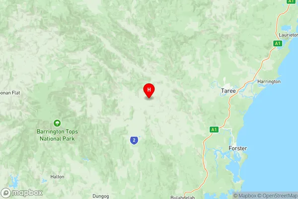
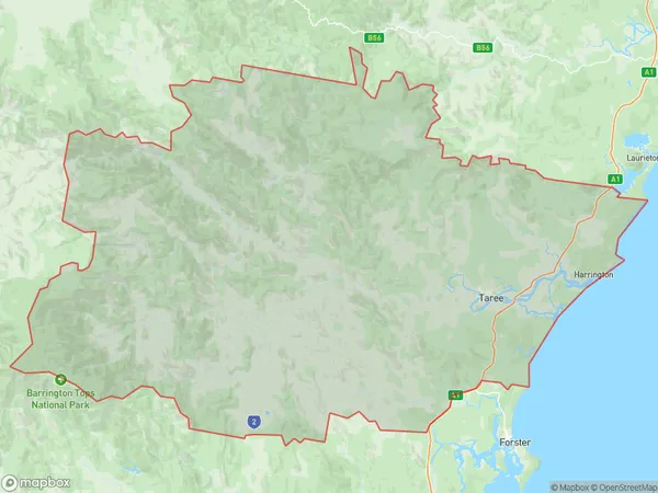
Taree Gloucester Suburbs & Region, Taree Gloucester Map & Postcodes
Taree Gloucester Suburbs & Region, Taree Gloucester Map & Postcodes in Taree Gloucester, Mid North Coast, NSW, AU
Taree Gloucester Region
Region Name
Taree Gloucester (NSW, AU)Taree Gloucester Area
6675 square kilometers (6,675 ㎢)Postal Codes
2312, 2337, 2415, from 2422 to 2424, 2426, 2427, 2429, 2430, and 2443 (In total, there are 11 postcodes in Taree Gloucester.)Taree Gloucester Introduction
Taree is a city in the Mid North Coast region of New South Wales, Australia. It is located on the Manning River and is the administrative center of the Taree Shire. The city has a population of around 10,000 people and is known for its agricultural industry, particularly the production of cotton and sugarcane. Taree also has a historic timber mill and a port on the Manning River. The city is surrounded by beautiful natural scenery, including the Manning River National Park and the Macleay River National Park.Australia State
City or Big Region
District or Regional Area
Taree Gloucester Region Map

Taree Gloucester Postcodes / Zip Codes
Taree Gloucester Suburbs
Old Bar Manning Point Red Head
Taree Gloucester full address
Taree Gloucester, Mid North Coast, New South Wales, NSW, Australia, SaCode: 10805Country
Taree Gloucester, Mid North Coast, New South Wales, NSW, Australia, SaCode: 10805
Taree Gloucester Suburbs & Region, Taree Gloucester Map & Postcodes has 7 areas or regions above, and there are 223 Taree Gloucester suburbs below. The sa3code for the Taree Gloucester region is 10805. Its latitude and longitude coordinates are -31.9538,152.022.
Taree Gloucester Suburbs & Localities
1. Minimbah
2. Dry Creek
3. Middle Brook
4. Belltrees
5. Glenbawn
6. Moobi
7. Nabiac
8. Ellerston
9. Glenrock
10. Gundy
11. Brawboy
12. Bunnan
13. Kars Springs
14. Moonan Brook
15. Omadale
16. Parkville
17. Waverly
18. Upper Karuah River
19. Weismantels
20. Moonan Flat
21. Berrico
22. Bretti
23. Bundook
24. Callaghans Creeks
25. Corroboree Flat
26. Gangat
27. Gloucester Tops
28. Invergordon
29. Pitlochry
30. Upper Bowman
31. Bombah Point
32. Wootton
33. Caffreys Flat
34. Cells River
35. Charity Creek
36. Number One
37. Boorganna
38. Cedar Party
39. Elands
40. Karaak Flat
41. Krambach
42. The Bight
43. Chatham
44. Failford
45. Ghinni Ghinni
46. Hallidays Point
47. Jones Island
48. Kiwarrak
49. Murulla
50. Pages Creek
51. Tomalla
52. Satur
53. Segenhoe
54. Stewarts Brook
55. Wingen
56. Monkerai
57. Back Creek
58. Bindera
59. Coneac
60. Glen Ward
61. Gloucester
62. Kia Ora
63. Titaatee Creek
64. Waukivory
65. Wirradgurie
66. Boolambayte
67. Nooroo
68. Mayers Flat
69. Willina
70. Coopernook
71. Harrington
72. Bucca Wauka
73. Bulga Forest
74. Bunyah
75. Khatambuhl
76. Killabakh
77. Kings Creek
78. Kippaxs
79. Marlee
80. Wherrol Flat
81. Wingham
82. Bootawa
83. Brimbin
84. Cabbage Tree Island
85. Dumaresq Island
86. Hillville
87. Bakers Creek
88. Barrington
89. Baxters Ridge
90. Belbora
91. Bulliac
92. Copeland
93. Craven
94. Craven Plateau
95. Dewitt
96. Faulkland
97. Forbesdale
98. Mernot
99. Mograni Creek
100. Stratford
101. Tugrabakh
102. Wallanbah
103. Wapra
104. Coolongolook
105. Markwell
106. Mungo Brush
107. Nerong
108. Seal Rocks
109. Violet Hill
110. Wang Wauk
111. Yagon
112. Cundle Flat
113. Knorrit Flat
114. Owens Gap
115. Knorrit Forest
116. Woodside
117. Crowdy Head
118. Bulby Brush
119. Comboyne
120. Dollys Flat
121. Firefly
122. Innes View
123. Kundibakh
124. Mooral Creek
125. Tipperary
126. Croki
127. Diamond Beach
128. Scone
129. Woolooma
130. Stroud Road
131. Barrington Tops
132. Bowman
133. Bowman Farm
134. Callaghans Creek
135. Cobark
136. Curricabark
137. Doon Ayre
138. Giro
139. Mares Run
140. Maudville
141. Mograni
142. Moppy
143. Mount Peerless
144. Rawdon Vale
145. Rookhurst
146. Terreel
147. Tibbuc
148. Wards River
149. Woko
150. Bulahdelah
151. Bungwahl
152. Crawford River
153. Myall Lake
154. Topi Topi
155. Upper Myall
156. Wallingat
157. Warranulla
158. Cooplacurripa
159. Mount George
160. Rocks Crossing
161. Tiri
162. Langley Vale
163. Moto
164. Bobin
165. Burrell Creek
166. Caparra
167. Dingo Forest
168. Dyers Crossing
169. Killawarra
170. Kimbriki
171. Strathcedar
172. Warriwillah
173. Yarratt Forest
174. Black Head
175. Bohnock
176. Cundletown
177. Glenthorne
178. Happy Valley
179. Kolodong
180. Lansdowne
181. Koorainghat
182. Manning Point
183. Rainbow Flat
184. Red Head
185. Tallwoods Village
186. Tinonee
187. Crowdy Bay
188. Deauville
189. Dunbogan
190. Stewarts River
191. Kundle Kundle
192. Old Bar
193. Possum Brush
194. Taree
195. Upper Lansdowne
196. Wallabi Point
197. Bobs Creek
198. Camden Head
199. Hannam Vale
200. Laurieton
201. North Brother
202. Lansdowne Forest
203. Melinga
204. Mitchells Island
205. Mondrook
206. Oxley Island
207. Pampoolah
208. Purfleet
209. Saltwater
210. Taree South
211. Taree West
212. Diamond Head
213. Herons Creek
214. North Haven
215. Waitui
216. West Haven
217. Taree Dc
218. Coralville
219. Dicks Hill
220. Johns River
221. Lakewood
222. Middle Brother
223. Moorland
