Geraldine Suburbs & Region, Geraldine Map & Postcodes in Geraldine, Canterbury
Geraldine Postcodes, Geraldine ZipCodes, Geraldine , Geraldine Canterbury, Geraldine Suburbs, Geraldine Region, Geraldine Map, Geraldine Area
Geraldine Region (Denfield Region)
Geraldine Suburbs
Geraldine is a city place type in Canterbury, NZ. It contains 12 suburbs or localities.Geraldine Postcodes
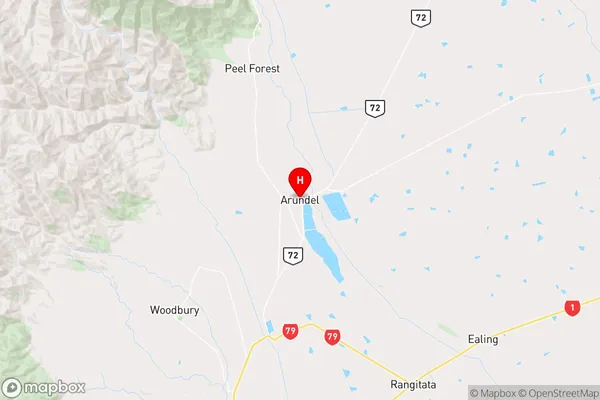
Geraldine Region Map
Geraldine Introduction
Geraldine is a town in the Canterbury region of New Zealand, located 90 kilometers south of Christchurch. It is known for its picturesque rural scenery, including rolling hills, farms, and the Geraldine Ranges. The town has a population of around 7,000 people and is a popular destination for tourists and outdoor enthusiasts. The Geraldine River runs through the town, and the surrounding area is popular for fishing, hiking, and skiing. The town also has a number of historic buildings, including the Geraldine Hotel, which was built in 1878.Geraldine Region
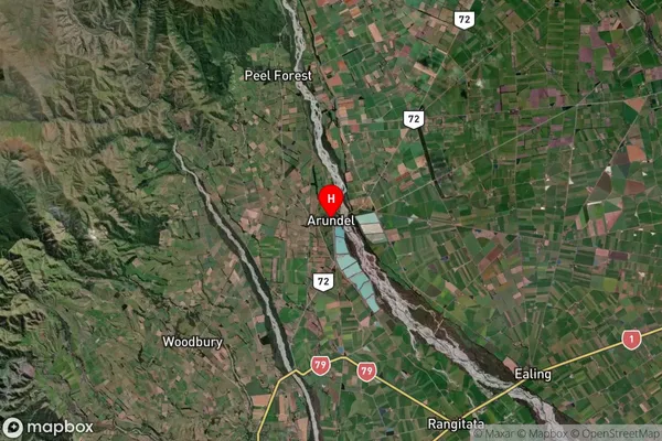
Geraldine Satellite Map
Full Address
Geraldine, CanterburyGeraldine Coordinates
-43.9762,171.293262 (Latitude / Longitude)Geraldine Map in NZ
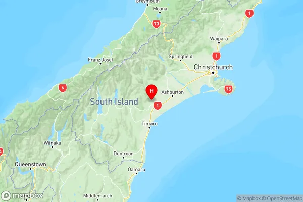
NZ Island
South IslandCountry
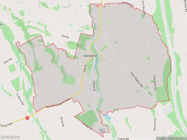
Geraldine Area Map (Polygon)
Name
GeraldineAdditional Name
DenfieldLocal Authority
Timaru District
Geraldine Suburbs (Sort by Population)
Geraldine
Geraldine - 3416Woodbury
Woodbury - 408Geraldine Downs
Geraldine Downs - 376Kakahu
Kakahu - 283Orari Bridge
Orari Bridge - 188Rangitata
Rangitata - 184Pleasant Valley
Pleasant Valley - 135Hilton
Hilton - 135Geraldine Flat
Geraldine Flat - 129Arundel
Arundel - 97Belfield
Belfield - 58Orari Gorge
Orari Gorge - 52