Porirua Suburbs & Region, Porirua Map & Postcodes in Porirua, Porirua City, Wellington
Porirua Postcodes, Porirua ZipCodes, Porirua , Porirua Wellington, Porirua Suburbs, Porirua Region, Porirua Map, Porirua Area
Porirua Region (Porirua East Region)
Porirua Suburbs
Porirua is a suburb place type in Porirua City, Wellington, NZ. It contains 21 suburbs or localities.Porirua Postcodes
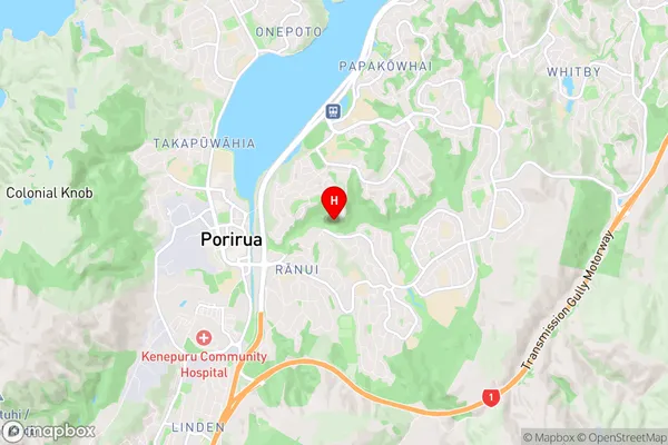
Porirua Region Map
Porirua Introduction
Porirua is a city in the Wellington Region of New Zealand, located on the northern shore of Porirua Harbour. It is a satellite city of Wellington and is part of the Greater Wellington metropolitan area. Porirua is known for its vibrant community, stunning natural surroundings, and easy access to the city of Wellington. The city has a population of around 60,000 people and is home to a diverse range of cultures and ethnicities. It is also home to a number of popular attractions, including the Porirua City Library, the Porirua Park Racecourse, and the Porirua Museum.Porirua Region
Porirua City
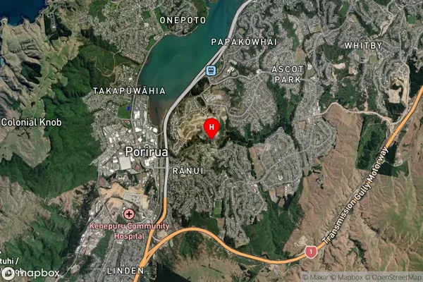
Porirua Satellite Map
Full Address
Porirua, Porirua City, WellingtonPorirua Coordinates
-41.133459,174.855624 (Latitude / Longitude)Porirua Map in NZ
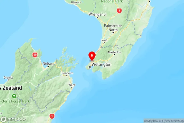
NZ Island
North IslandCountry
Porirua Area Map (Polygon)
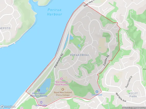
Name
PapakowhaiAdditional Name
Porirua EastLocal Authority
Porirua City
Porirua Suburbs (Sort by Population)
Whitby
Whitby - 11820Cannons Creek
Cannons Creek - 9474Titahi Bay
Titahi Bay - 8840Waitangirua
Waitangirua - 4650Aotea
Aotea - 4078Ranui
Ranui - 3876Ascot Park
Ascot Park - 2862Paremata
Paremata - 2676Papakowhai
Papakowhai - 2325Plimmerton
Plimmerton - 2225Pukerua Bay
Pukerua Bay - 2137Camborne
Camborne - 1808Takapuwahia
Takapuwahia - 1633Elsdon
Elsdon - 977Kenepuru
Kenepuru - 652Judgeford
Judgeford - 645Pauatahanui
Pauatahanui - 322Paekakariki Hill
Paekakariki Hill - 315Porirua City Centre
Porirua City Centre - 118Hongoeka
Hongoeka - 106Colonial Knob
Colonial Knob - 0