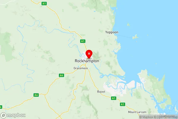
Rockhampton Suburbs & Region, Rockhampton Map & Postcodes
Rockhampton Suburbs & Region, Rockhampton Map & Postcodes in Rockhampton, Fitzroy, QLD, AU
Rockhampton Region
Region Name
Rockhampton (QLD, AU)Rockhampton Area
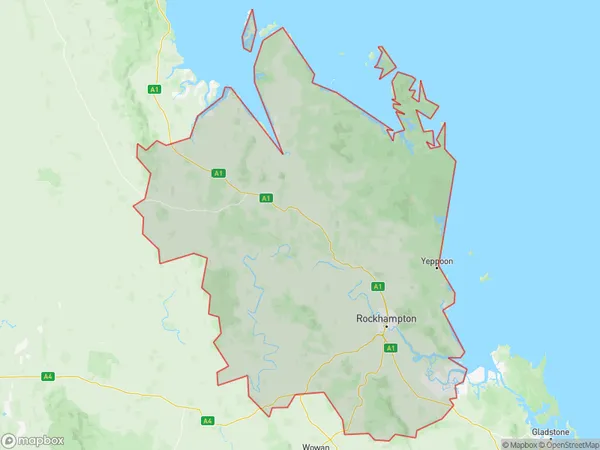
18328 square kilometers (18,328 ㎢)Postal Codes
from 4699 to 4704, 4706, 4710, 4711, 4714, and 4731 (In total, there are 11 postcodes in Rockhampton.)Rockhampton Introduction
Rockhampton is a city in Queensland, Australia, with a population of around 100,000 people. It is located in the central-western region of the state and is known for its rich agricultural industry, particularly beef and sugarcane production. The city has a number of historic buildings and landmarks, including the Rockhampton Botanic Gardens, the Rockhampton Art Gallery, and the Rockhampton Zoo. It is also home to a number of universities and colleges, including CQUniversity and the Central Queensland University.Australia State
City or Big Region
District or Regional Area
Rockhampton Region Map

Rockhampton Postcodes / Zip Codes
Rockhampton Suburbs
Bouldercombe
Frenchville Mount Archer
Glenlee Rockyview
Mount Morgan
Norman Gardens
Parkhurst Kawana
Rockhampton West
Rockhampton City
Rockhampton Region East
Rockhampton Region West
Shoalwater Bay
The Range Allenstown
Barcaldine Blackall
Rockhampton full address
Rockhampton, Fitzroy, Queensland, QLD, Australia, SaCode: 30803Country
Rockhampton, Fitzroy, Queensland, QLD, Australia, SaCode: 30803
Rockhampton Suburbs & Region, Rockhampton Map & Postcodes has 19 areas or regions above, and there are 204 Rockhampton suburbs below. The sa3code for the Rockhampton region is 30803. Its latitude and longitude coordinates are -23.3667,150.533.
Rockhampton Suburbs & Localities
1. Bajool
2. Allenstown
3. Port Curtis
4. Rockhampton City
5. Greenlake
6. Koongal
7. Limestone Creek
8. Oasis Gardens
9. Rockhampton North
10. The Common
11. Alberta
12. Alsace
13. Alton Downs
14. Anakie
15. Anakie Siding
16. Arcturus
17. Argoon
18. Baralaba
19. Barnard
20. Boolburra
21. Cawarral
22. Cheeseborough
23. Coorumbene
24. Gindie
25. Jellinbah
26. Joskeleigh
27. Keppel Sands
28. Kunwarara
29. Lowesby
30. Mimosa
31. Moonmera
32. Morinish South
33. Mount Chalmers
34. Rannes
35. Rossmoya
36. South Yaamba
37. Stanage
38. The Caves
39. Ulogie
40. Barmoya
41. Bungundarra
42. Farnborough
43. Kemp Beach
44. Lake Mary
45. Lammermoor Beach
46. Maryvale
47. Pacific Heights
48. Stockyard
49. Weerriba
50. Yaamba
51. Emu Park
52. Glendale
53. Leydens Hill
54. Limestone
55. Nine Mile Creek
56. Port Alma
57. Great Keppel Island
58. Wandal
59. Central Queensland University
60. Kawana
61. Nerimbera
62. North Rockhampton
63. Rockhampton Shopping Fair
64. Bingegang
65. Bogantungan
66. Canoona
67. Carnarvon Park
68. Central Queensland Mc
69. Coomoo
70. Coowonga
71. Dingo
72. Gainsford
73. Garnant
74. Goovigen
75. Gracemere
76. Jambin
77. Kabra
78. Kokotungo
79. Mackenzie
80. Midgee
81. Morinish
82. Nine Mile
83. Parkhurst
84. Plum Tree
85. Ridgelands
86. Sapphire
87. Smoky Creek
88. Stanwell
89. Tarramba
90. Togara
91. Tungamull
92. Willows
93. Willows Gemfields
94. Withersfield
95. Woolein
96. Wowan
97. Yalleroi
98. Yaraka
99. Adelaide Park
100. Bangalee
101. Bayfield
102. Bondoola
103. Byfield
104. Hidden Valley
105. Lammermoor
106. Mulambin
107. Mulara
108. Rosslyn
109. Statue Bay
110. Tanby
111. Taranganba
112. Taroomball
113. Woodbury
114. Yeppoon
115. Wattlebank
116. Glenlee
117. Baree
118. Hamilton Creek
119. Moongan
120. The Mine
121. Walmul
122. Wura
123. Rockhampton
124. Rockhampton Hospital
125. The Keppels
126. The Range
127. West Rockhampton
128. Ironpot
129. Kalka
130. Lakes Creek
131. Nankin
132. Park Avenue
133. Rockyview
134. Sandringham
135. Banana
136. Bluff
137. Bouldercombe
138. Canal Creek
139. Comet
140. Coorooman
141. Dumpy Creek
142. Dundula Creek
143. Etna Creek
144. Gemfields
145. Glenroy
146. Goowarra
147. Humboldt
148. Marmor
149. Pheasant Creek
150. Pink Lily
151. Rewan
152. Rolleston
153. Rubyvale
154. Stewarton
155. The Gemfields
156. Thompson Point
157. Wycarbah
158. Barlows Hill
159. Causeway Lake
160. Cobraball
161. Inverness
162. Kinka Beach
163. Horse Creek
164. Johnsons Hill
165. Mount Morgan
166. Struck Oil
167. Yaraka
168. Depot Hill
169. Fairy Bower
170. Berserker
171. Frenchville
172. Mount Archer
173. Norman Gardens
174. Red Hill Rockhampton
175. Rockhampton Dc
176. Balcomba
177. Blackdown
178. Bushley
179. Consuelo
180. Dalma
181. Dixalea
182. Dululu
183. Fernlees
184. Gogango
185. Goomally
186. Gordonstone
187. Jardine
188. Kalapa
189. Milman
190. Sapphire Central
191. Shoalwater
192. Wallaroo
193. Westwood
194. Wooroona
195. Barmaryee
196. Cooee Bay
197. Meikleville Hill
198. Ogmore
199. Zilzie
200. Boulder Creek
201. Fletcher Creek
202. Oakey Creek
203. Trotter Creek
204. Walterhall
