Cairns South Suburbs & Region, Cairns South Map & Postcodes
Cairns South Suburbs & Region, Cairns South Map & Postcodes in Cairns South, Cairns, QLD, AU
Cairns South Region
Region Name
Cairns South (QLD, AU)Cairns South Area
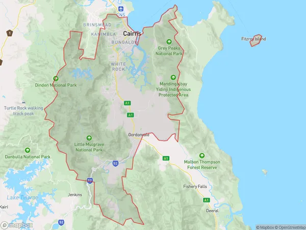
633.48 square kilometers (633.48 ㎢)Cairns South Suburb Area Map (Polygon)
Cairns South Introduction
Cairns South is a suburb in Cairns, Queensland, Australia. It is located in the city's south-east and is part of the Cairns Region local government area. The suburb is home to a variety of attractions, including Cairns Botanic Gardens, Cairns Zoological Gardens, and Cairns Convention Centre. It is also a popular destination for tourists, with many hotels and resorts located in the area. Cairns South is a relatively new suburb, with most of the development occurring in the late 20th century. It is a well-planned suburb with a variety of housing options, including apartments, townhouses, and single-family homes. The suburb is also home to a number of schools, including Cairns South State School and Cairns State High School.Australia State
City or Big Region
District or Regional Area
Cairns South Region Map
Cairns South Suburbs
Healesville Yarra Glen
Freshwater Stratford
Bentley Park
Earlville Bayview Heights
Kanimbla Mooroobool
Mount Sheridan
Westcourt Bungalow
Whitfield Edge Hill
Cairns South full address
Cairns South, Cairns, Queensland, QLD, Australia, SaCode: 30602Country
Cairns South, Cairns, Queensland, QLD, Australia, SaCode: 30602
Cairns South Suburbs & Region, Cairns South Map & Postcodes has 15 areas or regions above, and there are 0 Cairns South suburbs below. The sa3code for the Cairns South region is 30602. Its latitude and longitude coordinates are -17.004,145.738.