Shepparton Suburbs & Region, Shepparton Map & Postcodes
Shepparton Suburbs & Region, Shepparton Map & Postcodes in Shepparton, VIC, AU
Shepparton Region
Region Name
Shepparton (VIC, AU)Shepparton Area
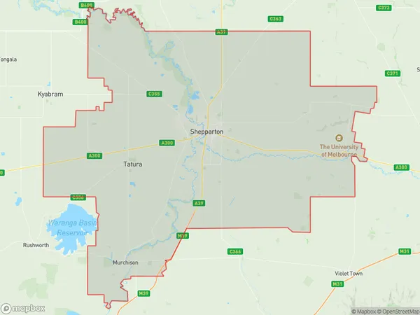
2333 square kilometers (2,333 ㎢)Postal Codes
3608, 3610, 3614, from 3616 to 3620, 3623, from 3629 to 3634, 3646, 3647, and 3669 (In total, there are 18 postcodes in Shepparton.)Shepparton Introduction
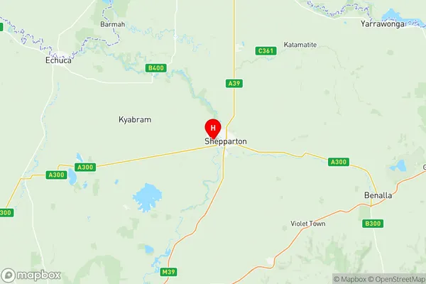
Shepparton is a city in north-central Victoria, Australia. It is located on the Murray River, at the junction of the Goulburn and Broken rivers, and is approximately 165 kilometers (102 miles) north-west of Melbourne. The city has a population of around 30,000 people and is known for its agriculture, particularly its production of cotton, wheat, and sheep. Shepparton has a number of historic buildings and landmarks, including the Shepparton Art Museum, the Shepparton Performing Arts Centre, and the Shepparton Botanical Gardens. The city is also home to a number of festivals and events, including the Shepparton Festival of Food and Wine and the Shepparton Show.Australia State
City or Big Region
District or Regional Area
Shepparton Region Map

Shepparton Postcodes / Zip Codes
Shepparton Suburbs
Nagambie
Rushworth
Mooroopna
Shepparton North
Shepparton South
Shepparton Region East
Shepparton Region West
Shepparton South East
Shepparton full address
Shepparton, Victoria, VIC, Australia, SaCode: 21603Country
Shepparton, Victoria, VIC, Australia, SaCode: 21603
Shepparton Suburbs & Region, Shepparton Map & Postcodes has 10 areas or regions above, and there are 96 Shepparton suburbs below. The sa3code for the Shepparton region is 21603. Its latitude and longitude coordinates are -36.3833,145.35.
Shepparton Suburbs & Localities
1. Goulburn Weir
2. Kirwans Bridge
3. Nagambie
4. Dhurringile
5. Moorilim
6. Murchison
7. Toolamba
8. Girgarre East
9. Wyuna
10. Coomboona
11. Arcadia South
12. Karramomus
13. Kialla East
14. Kialla West
15. Invergordon South
16. Katandra
17. Marionvale
18. Mount Major
19. Dookie College
20. Wirrate
21. Toolamba West
22. Cooma
23. Tatura
24. Tatura East
25. Waranga
26. Lancaster
27. Mount Scobie
28. Taripta
29. Stanhope
30. Mooroopna
31. Mooroopna North
32. Undera
33. Branditt
34. Colliver
35. Shepparton
36. Cosgrove
37. Cosgrove South
38. Lemnos
39. Shepparton East
40. Tamleugh West
41. Katandra West
42. Zeerust
43. Upotipotpon
44. Violet Town
45. Dookie
46. Nalinga
47. Waggarandall
48. Wattville
49. Youanmite
50. Earlston
51. Marraweeney
52. Bailieston
53. Murchison North
54. Gillieston
55. Harston
56. Mooroopna North West
57. Toolamba West
58. Byrneside
59. Kyabram
60. Wyuna East
61. Carag Carag
62. Stanhope South
63. Ardmona
64. Dunkirk
65. Grahamvale
66. Orrvale
67. Pine Lodge
68. Tallygaroopna
69. Yabba North
70. Yabba South
71. Graytown
72. Mitchellstown
73. Wahring
74. Murchison East
75. Merrigum
76. Kyabram
77. Kyabram South
78. St Germains
79. Benarch
80. Caniambo
81. Shepparton South
82. Arcadia
83. Branditt
84. Kialla
85. Shepparton North
86. Shepparton
87. Congupna
88. Bunbartha
89. Marungi
90. Creek Junction
91. Koonda
92. Tamleugh
93. Tamleugh North
94. Boho
95. Boho South
96. Gowangardie
