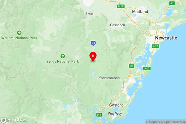
Hawkesbury Suburbs & Region, Hawkesbury Map & Postcodes
Hawkesbury Suburbs & Region, Hawkesbury Map & Postcodes in Hawkesbury, Sydney Baulkham Hills and Hawkesbury, NSW, AU
Hawkesbury Region
Region Name
Hawkesbury (NSW, AU)Hawkesbury Area
2492 square kilometers (2,492 ㎢)Postal Codes
2250, 2330, 2757, and 2775 (In total, there are 4 postcodes in Hawkesbury.)Hawkesbury Introduction
Hawkesbury is a suburb in the local government area of the City of Hawkesbury, located in the Hawkesbury region of New South Wales, Australia. Hawkesbury is located 50 kilometers (31 mi) northwest of Sydney's central business district, on the banks of the Hawkesbury River. The suburb was named after the Hawkesbury River, which flows through it. The first settlers in the area were convicts who were sent to the area in 1788. The first free settlers arrived in the area in 1810. Hawkesbury is a popular tourist destination, with many visitors coming to the area to enjoy the natural beauty of the Hawkesbury River and the surrounding countryside. The suburb is home to many historic buildings, including the Hawkesbury River Museum and the Hawkesbury Racecourse. The suburb has a population of around 35,000 people and is a growing area. There are many new housing developments in the area, as well as a number of shopping centers and restaurants. Hawkesbury is a great place to live and work, with a relaxed and friendly community atmosphere. The suburb is well-connected to Sydney, with easy access to the M4 motorway and public transport.Australia State
City or Big Region
District or Regional Area
Hawkesbury Region Map

Hawkesbury Postcodes / Zip Codes
Hawkesbury Suburbs
Dural Kenthurst Wisemans Ferry
Hawkesbury full address
Hawkesbury, Sydney Baulkham Hills and Hawkesbury, New South Wales, NSW, Australia, SaCode: 11503Country
Hawkesbury, Sydney Baulkham Hills and Hawkesbury, New South Wales, NSW, Australia, SaCode: 11503
Hawkesbury Suburbs & Region, Hawkesbury Map & Postcodes has 9 areas or regions above, and there are 120 Hawkesbury suburbs below. The sa3code for the Hawkesbury region is 11503. Its latitude and longitude coordinates are -33.1067,151.134.
Hawkesbury Suburbs & Localities
1. Erina
2. Kulnura
3. Lisarow
4. Mangrove Mountain
5. Matcham
6. Mount Elliot
7. Narara
8. Niagara Park
9. West Gosford
10. Bucketty
11. East Gosford
12. Gosford
13. Lower Mangrove
14. Point Frederick
15. Bowmans Creek
16. Camberwell
17. Dunolly
18. Goorangoola
19. Gowrie
20. Mitchells Flat
21. Mount Olive
22. Ravensworth
23. Rixs Creek
24. Sedgefield
25. St Clair
26. Westbrook
27. Wylies Flat
28. Bulga
29. Clydesdale
30. Combo
31. Darlington
32. Doyles Creek
33. Falbrook
34. Fern Gully
35. Fordwich
36. Garland Valley
37. Glendon
38. Gouldsville
39. Greenlands
40. Howick
41. Jerrys Plains
42. Lemington
43. Mount Thorley
44. Redbournberry
45. Scotts Flat
46. Singleton
47. Singleton Dc
48. Wattle Ponds
49. Whittingham
50. Calga
51. Donovans Forest
52. Erina Fair
53. Greengrove
54. Holgate
55. Mount White
56. Point Clare
57. Springfield
58. Tascott
59. Upper Mangrove
60. Wyoming
61. Central Mangrove
62. Glenworth Valley
63. Gosford West
64. Kariong
65. Mangrove Creek
66. Mooney Mooney Creek
67. North Gosford
68. Peats Ridge
69. Somersby
70. Ten Mile Hollow
71. Wendoree Park
72. Big Ridge
73. Big Yengo
74. Broke
75. Glendonbrook
76. Hebden
77. Milbrodale
78. Mirannie
79. Mount Royal
80. Obanvale
81. Putty
82. Roughit
83. Wollemi
84. Appletree Flat
85. Bridgman
86. Carrowbrook
87. Dural
88. Dyrring
89. Glendon Brook
90. Glennies Creek
91. Glenridding
92. Hambledon Hill
93. Howes Valley
94. Hunterview
95. Long Point
96. Maison Dieu
97. Mcdougalls Hill
98. Middle Falbrook
99. Reedy Creek
100. Singleton Heights
101. Warkworth
102. Kurmond
103. Fernances
104. Lower Macdonald
105. Wrights Creek
106. Central Macdonald
107. Marlow
108. Perrys Crossing
109. St Albans
110. Upper Macdonald
111. Webbs Creek
112. Gunderman
113. Laughtondale
114. Mogo Creek
115. Singletons Mill
116. Spencer
117. Higher Macdonald
118. Leets Vale
119. Lower Hawkesbury
120. Wisemans Ferry
