Dural Kenthurst Wisemans Ferry Suburbs & Region, Dural Kenthurst Wisemans Ferry Map & Postcodes
Dural Kenthurst Wisemans Ferry Suburbs & Region, Dural Kenthurst Wisemans Ferry Map & Postcodes in Dural Kenthurst Wisemans Ferry, Hawkesbury, Sydney Baulkham Hills and Hawkesbury, NSW, AU
Dural Kenthurst Wisemans Ferry Region
Region Name
Dural Kenthurst Wisemans Ferry (NSW, AU)Dural Kenthurst Wisemans Ferry Area
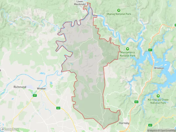
377.54 square kilometers (377.54 ㎢)Postal Codes
from 2156 to 2158, 2756, and 2775 (In total, there are 5 postcodes in Dural Kenthurst Wisemans Ferry.)Dural Kenthurst Wisemans Ferry Introduction
Dural Kenthurst Wisemans Ferry is a suburb located in the Hills District of Sydney, in New South Wales, Australia. It is situated 38 kilometers northwest of Sydney's central business district and is part of the Macarthur region. The suburb is named after the Wisemans Ferry bridge that connects it to the Sydney central business district. Dural Kenthurst Wisemans Ferry is a well-established suburb with a mix of residential and commercial properties. The area has a variety of shops, cafes, and restaurants, as well as a community center and a library. The suburb is also home to several parks and recreational facilities, including the Wisemans Ferry Reserve and the Dural Country Club. The population of Dural Kenthurst Wisemans Ferry is estimated to be around 10,000 people, with a diverse population that includes families, young professionals, and retirees. The suburb has a low crime rate and is known for its peaceful and quiet atmosphere. Transportation in Dural Kenthurst Wisemans Ferry is excellent, with the suburb well-connected to the Sydney central business district by road and rail. The M2 motorway is located nearby, providing easy access to other parts of the city and region. The suburb is also served by several bus routes, including the 628 and 629 services that connect it to the city center. In conclusion, Dural Kenthurst Wisemans FerryAustralia State
City or Big Region
Greater Capital City
Greater Sydney (1GSYD)District or Regional Area
Suburb Name
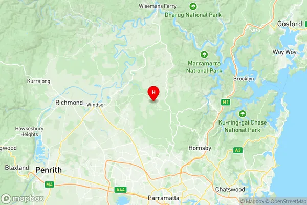
Dural Kenthurst Wisemans Ferry Region Map

Dural Kenthurst Wisemans Ferry Postcodes / Zip Codes
Dural Kenthurst Wisemans Ferry Suburbs
Dural Kenthurst Wisemans Ferry full address
Dural Kenthurst Wisemans Ferry, Hawkesbury, Sydney Baulkham Hills and Hawkesbury, New South Wales, NSW, Australia, SaCode: 115021297Country
Dural Kenthurst Wisemans Ferry, Hawkesbury, Sydney Baulkham Hills and Hawkesbury, New South Wales, NSW, Australia, SaCode: 115021297
Dural Kenthurst Wisemans Ferry Suburbs & Region, Dural Kenthurst Wisemans Ferry Map & Postcodes has 0 areas or regions above, and there are 17 Dural Kenthurst Wisemans Ferry suburbs below. The sa2code for the Dural Kenthurst Wisemans Ferry region is 115021297. Its latitude and longitude coordinates are -33.601,150.976. Dural Kenthurst Wisemans Ferry area belongs to Australia's greater capital city Greater Sydney.
Dural Kenthurst Wisemans Ferry Suburbs & Localities
1. Annangrove
2. Canoelands
3. Forest Glen
4. Dural Dc
5. Middle Dural
6. Round Corner
7. Kenthurst
8. Glenorie
10. Hillside
11. Leets Vale
12. Sackville North
14. Maroota
15. South Maroota
16. Leets Vale
17. Wisemans Ferry
