Outback North and East Suburbs & Region, Outback North and East Map & Postcodes
Outback North and East Suburbs & Region, Outback North and East Map & Postcodes in Outback North and East, South Australia Outback, SA, AU
Outback North and East Region
Region Name
Outback North and East (SA, AU)Outback North and East Area
642478 square kilometers (642,478 ㎢)Postal Codes
from 5432 to 5434, 5485, 5600, 5601, 5611, 5700, 5701, 5710, 5717, 5719, 5720, from 5722 to 5725, and from 5730 to 5734 (In total, there are 22 postcodes in Outback North and East.)Outback North and East Suburb Area Map (Polygon)
Outback North and East Introduction
Outback North and East, South Australia Outback, South Australia, AU, is a vast and remote region of Australia known for its stunning landscapes, rich history, and unique wildlife. It is located in the northeastern part of the state and covers an area of approximately 1.5 million square kilometers. The Outback is characterized by its red soil, rocky outcroppings, and dry, hot climate. It is home to a variety of animals, including kangaroos, wallabies, emus, and koalas. The region is also home to several indigenous communities, including the Arrernte, Anangu, and Pitjantjatjara. The Outback has a rich history, dating back thousands of years. It was home to the indigenous peoples of Australia for many centuries before the arrival of European settlers. The region was also a major center of gold mining during the late 19th and early 20th centuries. Today, the Outback is a popular tourist destination, attracting visitors from around the world to explore its stunning landscapes, learn about its rich history, and experience its unique wildlife. The region is also home to several national parks and reserves, including the Uluru-Kata Tjuta National Park and the Flinders Ranges National Park.Australia State
City or Big Region
District or Regional Area
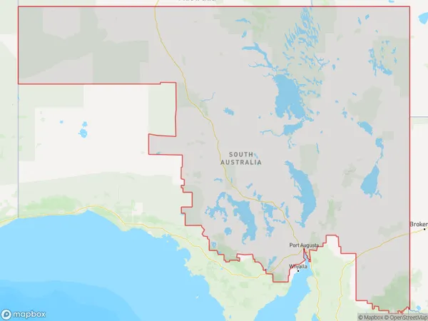
Outback North and East Region Map
Outback North and East Postcodes / Zip Codes
Outback North and East Suburbs
Outback North and East full address
Outback North and East, South Australia Outback, South Australia, SA, Australia, SaCode: 40602Country
Outback North and East, South Australia Outback, South Australia, SA, Australia, SaCode: 40602
Outback North and East Suburbs & Region, Outback North and East Map & Postcodes has 7 areas or regions above, and there are 217 Outback North and East suburbs below. The sa3code for the Outback North and East region is 40602. Its latitude and longitude coordinates are -27.3158,133.298.
Outback North and East Suburbs & Localities
1. Carrieton
2. Cradock
3. Holowiliena
4. Moockra
5. Willippa
7. Bibliando
8. Holowiliena South
9. Witchitie
10. Saltia
11. Stephenston
12. Flinders Ranges
13. Kanyaka
14. Upalinna
15. Quorn
16. Willochra
17. Black Hill Station
18. Willow Springs
19. Belton
20. Three Creeks
21. Wilcowie
22. Yarrah
23. Barndioota
24. Hawker
25. Baratta
26. Yanyarrie
27. Mount Havelock
28. Prelinna
29. Shaggy Ridge
30. Worumba
31. Wilmington
32. Iron Baron
33. Douglas Point
34. Whyalla Barson
35. Corunna Station
36. Katunga Station
37. Davenport
38. Port Augusta West
39. Wami Kata
40. Tarcoola
41. Cook
42. Stirling North
43. Whyalla
44. Whyalla Playford
45. Douglas Point South
46. False Bay
47. Fitzgerald Bay
48. Point Lowly North
49. Cooyerdoo
50. Gilles Downs
51. Secret Rocks
52. Kolendo
53. Lake Everard
54. Thurlga
55. Glendambo
56. Lake Harris
57. Mulgathing
58. Wilgena
59. Wirraminna
60. Parakylia
61. Pimba
62. Arckaringa
63. Mount Willoughby
64. Wintinna
65. Welbourn Hill
66. Olympic Dam
67. Blinman
68. Gum Creek Station
69. Motpena
70. Mount Falkland
71. Narrina
72. Nilpena
73. Puttapa
74. Cordillo Downs
75. Witchelina
76. Gammon Ranges
77. Manners Well
78. Mulga View
79. Umberatana
80. Alton Downs Station
81. Etadunna
82. Farina
83. Lake Eyre
84. Mulka
85. Eringa
86. Blanche Harbor
87. Commissariat Point
88. Port Augusta
89. Port Augusta North
90. Woolundunga
91. Kingoonya
92. Hiltaba
93. Kokatha
94. Lake Macfarlane
95. Moonaree
96. Mount Ive
97. Siam
98. Uno
99. Bon Bon
100. Bulgunnia
101. Kingoonya
102. Mount Eba
103. Mount Vivian
104. Stuarts Creek
105. Andamooka Station
106. Allandale Station
107. Anna Creek
108. Mount Clarence Station
109. Marla
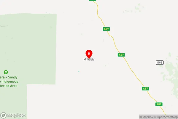
110. Mintabie
111. Ediacara
112. Moolooloo
113. Oratunga Station
114. Warraweena
115. Coopers Creek
116. Leigh Creek
117. Lindon
118. Lyndhurst
119. Moolawatana
120. Mount Freeling
121. Mount Lyndhurst
122. Arkaroola
123. Burr Well
124. North Moolooloo
125. Pinda Springs
126. Clayton Station
127. Cowarie
128. Kalamurina
129. Mungeranie
130. Macumba
131. Simpson Desert
132. Backy Point
133. Iron Knob
134. Point Lowly
135. Iron Knob
136. Myola Station
137. Whyalla Dc
138. Port Bonython
139. Iron Baron
140. Lake Gilles
141. Miranda
142. Mundallio
143. Port Paterson
144. Winninowie
145. Arkaroola Village
146. Glendambo
147. Nonning
148. Port Augusta
149. Mahanewo
150. Yardea
151. Coondambo
152. Arcoona
153. Billa Kalina
154. Bosworth
155. Millers Creek
156. Purple Downs
157. Woomera
158. Andamooka
159. Mcdouall Peak
160. Nilpinna Station
161. William Creek
162. Roxby Downs
163. Roxby Downs Station
164. Beltana Station
165. Parachilna
166. Bollards Lagoon
167. Durham Downs
168. Leigh Creek Station
169. Myrtle Springs
170. Mount Serle
171. Nepabunna
172. Wertaloona
173. Wooltana
174. Callanna
175. Clifton Hills Station
176. Marree
177. Pandie Pandie
178. Crown Point
179. Todmorden
180. Witjira
181. Cultana
182. Willsden
183. Cook
184. Port Augusta
185. Tarcoola
186. Kondoolka
187. Lake Gairdner
188. Nonning
189. Commonwealth Hill
190. Coober Pedy
191. Evelyn Downs
192. Ingomar
193. Mabel Creek
194. Mount Barry
195. Alpana
196. Angorigina
197. Beltana
198. Moorillah
199. Wirrealpa
200. Farina
201. Farina Station
202. Gidgealpa
203. Innamincka
204. Merty Merty
205. Mulgaria
206. Murnpeowie
207. Strzelecki Desert
208. Angepena
209. Copley
210. Moolawatana
211. Yankaninna
212. Dulkaninna
213. Marree Station
214. Muloorina
215. Mundowdna
216. Mount Sarah
217. Oodnadatta