Port Adelaide West Suburbs & Region, Port Adelaide West Map & Postcodes
Port Adelaide West Suburbs & Region, Port Adelaide West Map & Postcodes in Port Adelaide West, Adelaide West, SA, AU
Port Adelaide West Region
Region Name
Port Adelaide West (SA, AU)Port Adelaide West Area
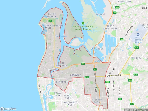
67.77 square kilometers (67.77 ㎢)Port Adelaide West Suburb Area Map (Polygon)
Port Adelaide West Introduction
Port Adelaide West is a suburb of Adelaide in South Australia. It is located in the City of Charles Sturt and is bordered by the Marion and Port Adelaide suburbs. The suburb has a population of around 3,000 people and is known for its historic port and industrial heritage. The Port Adelaide West Football Club is a local Australian Rules Football Club that competes in the South Australian National Football League (SANFL). The club was founded in 1877 and has won six premierships, including the last one in 2018. The suburb also has a number of parks and recreational facilities, including the Port Adelaide West Beach and the Port Adelaide West Golf Course.Australia State
City or Big Region
District or Regional Area
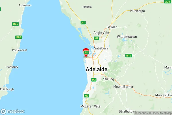
Port Adelaide West Region Map
Port Adelaide West Suburbs
Enfield Blair Athol
Hindmarsh Brompton
Royal Park Hendon Albert Park
Woodville Cheltenham
Largs Bay Semaphore
Port Adelaide West full address
Port Adelaide West, Adelaide West, South Australia, SA, Australia, SaCode: 40402Country
Port Adelaide West, Adelaide West, South Australia, SA, Australia, SaCode: 40402
Port Adelaide West Suburbs & Region, Port Adelaide West Map & Postcodes has 10 areas or regions above, and there are 0 Port Adelaide West suburbs below. The sa3code for the Port Adelaide West region is 40402. Its latitude and longitude coordinates are -34.836,138.5.