Athol Park Area, Athol Park Postcode(5012) & Map in Athol Park, Adelaide - West, SA
Athol Park Area, Athol Park Postcode(5012) & Map in Athol Park, Adelaide - West, SA, AU, Postcode: 5012
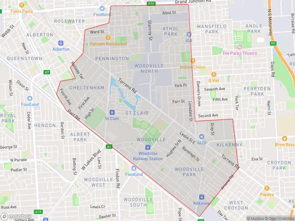
Athol Park, Woodville - Cheltenham, Charles Sturt, Adelaide - West, South Australia, Australia, 5012
Athol Park Postcode
Area Name
Athol ParkAthol Park Suburb Area Map (Polygon)
Athol Park Introduction
Athol Park is a suburb of Adelaide, South Australia, located 10 km west of the city center. It is known for its parks and gardens, including the popular Athol Park Golf Course. The suburb has a mix of residential and commercial areas and is home to a variety of businesses and amenities.State Name
City or Big Region
District or Regional Area
Suburb Name
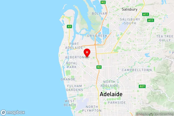
Athol Park Region Map

Country
Main Region in AU
R2Coordinates
-34.858,138.543 (latitude/longitude)Athol Park Area Map (Street)
Longitude
138.541637Latitude
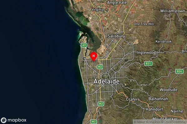
-34.86303Athol Park Suburb Map (Satellite)
Distances
The distance from Athol Park, Adelaide - West, SA to AU Greater Capital CitiesSA1 Code 2011
40401109718SA1 Code 2016
40401109718SA2 Code
404011097SA3 Code
40401SA4 Code
404RA 2011
1RA 2016
1MMM 2015
1MMM 2019
1Charge Zone
S1LGA Region
Port Adelaide EnfieldLGA Code
45890Electorate
Hindmarsh