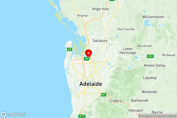
Enfield Blair Athol Suburbs & Region, Enfield Blair Athol Map & Postcodes
Enfield Blair Athol Suburbs & Region, Enfield Blair Athol Map & Postcodes in Enfield Blair Athol, Port Adelaide West, Adelaide West, SA, AU
Enfield Blair Athol Region
Region Name
Enfield Blair Athol (SA, AU)Enfield Blair Athol Area
15.18 square kilometers (15.18 ㎢)Postal Codes
from 5083 to 5085, and 5094 (In total, there are 4 postcodes in Enfield Blair Athol.)Enfield Blair Athol Introduction
Enfield Blair Athol is a suburb of Adelaide in the Australian state of South Australia. It is located in the City of Charles Sturt and is named after the Scottish baronet Sir John Blair Athol. The suburb is located in the western suburbs of Adelaide and is bordered by the suburbs of Blair Athol, Enfield, Goodwood, and Walkerville. The suburb has a variety of housing styles, including single-story homes, duplexes, and apartments. The majority of the homes in the suburb were built in the 1950s and 1960s, and there are also some newer developments. The suburb is well-serviced by public transport, with several bus routes and the Enfield Train Station located within walking distance. Enfield Blair Athol has a variety of shops and services, including a supermarket, a pharmacy, a post office, and several cafes and restaurants. The suburb also has a community center and a park, which is popular with locals for picnics and sports. The suburb is home to a number of schools, including Enfield Primary School, Blair Athol Primary School, and Goodwood Primary School. There are also several secondary schools in the area, including St Peter's College and John Paul College. Enfield Blair Athol is a popular suburb for families and young professionals, with a friendly and welcoming community. The suburb is well-connected to the rest of Adelaide and hasAustralia State
City or Big Region
Greater Capital City
Greater Adelaide (4GADE)District or Regional Area
Suburb Name
Enfield Blair Athol Region Map

Enfield Blair Athol Postcodes / Zip Codes
Enfield Blair Athol Suburbs
Enfield Blair Athol full address
Enfield Blair Athol, Port Adelaide West, Adelaide West, South Australia, SA, Australia, SaCode: 402031036Country
Enfield Blair Athol, Port Adelaide West, Adelaide West, South Australia, SA, Australia, SaCode: 402031036
Enfield Blair Athol Suburbs & Region, Enfield Blair Athol Map & Postcodes has 0 areas or regions above, and there are 11 Enfield Blair Athol suburbs below. The sa2code for the Enfield Blair Athol region is 402031036. Its latitude and longitude coordinates are -34.8334,138.59. Enfield Blair Athol area belongs to Australia's greater capital city Greater Adelaide.
Enfield Blair Athol Suburbs & Localities
1. Broadview
2. Clearview
3. Blair Athol
4. Sefton Park
5. Blair Athol West
6. Kilburn
7. Enfield Plaza
8. Gepps Cross
9. Kilburn North
10. Enfield
11. Dry Creek
