Largs Bay Area, Largs Bay Postcode(5016) & Map in Largs Bay, Adelaide - West, SA
Largs Bay Area, Largs Bay Postcode(5016) & Map in Largs Bay, Adelaide - West, SA, AU, Postcode: 5016
Largs Bay, Largs Bay - Semaphore, Port Adelaide - West, Adelaide - West, South Australia, Australia, 5016
Largs Bay Postcode
Area Name
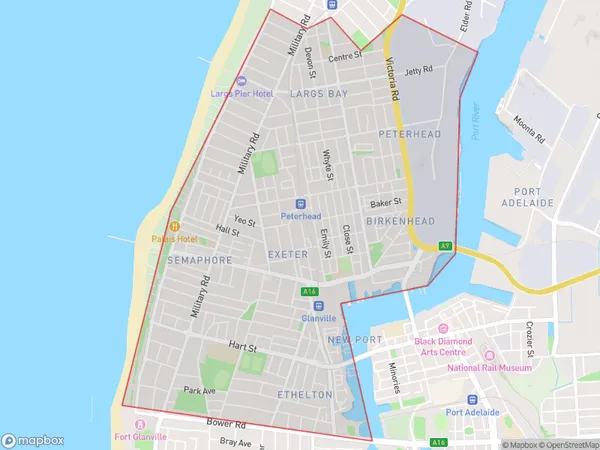
Largs BayLargs Bay Suburb Area Map (Polygon)
Largs Bay Introduction
Largs Bay is a suburb of Adelaide, South Australia, located on the western shore of the Port River. It is known for its beaches, parks, and recreational facilities, including the Largs Bay Beach and the Largs Bay Golf Course. The suburb has a population of approximately 7,000 people and is home to a variety of businesses and amenities.State Name
City or Big Region
District or Regional Area
Suburb Name
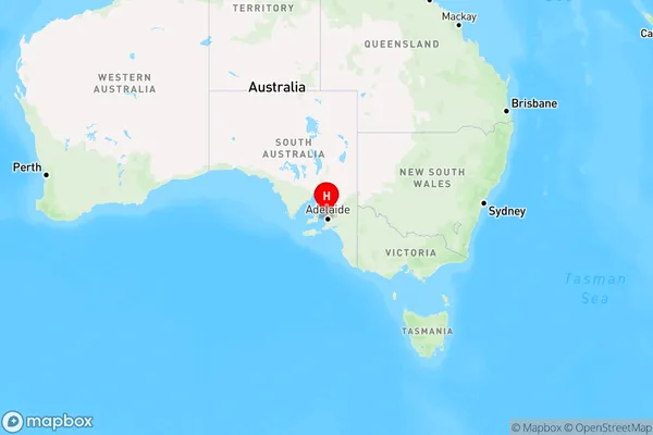
Largs Bay Region Map
Country
Main Region in AU
R2Coordinates
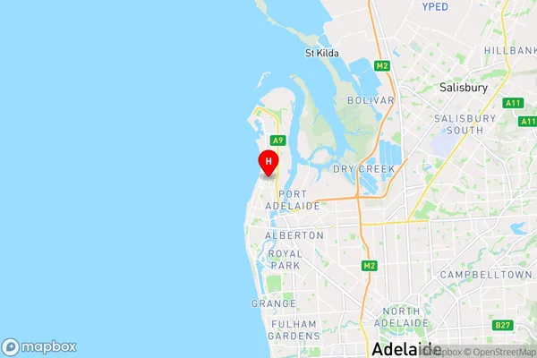
-34.821,138.494 (latitude/longitude)Largs Bay Area Map (Street)
Longitude
138.493796Latitude
-34.824516Largs Bay Elevation
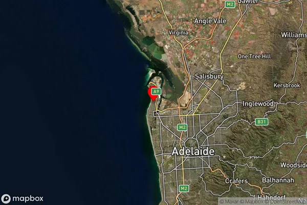
about 3.98 meters height above sea level (Altitude)Largs Bay Suburb Map (Satellite)
Distances
The distance from Largs Bay, Adelaide - West, SA to AU Greater Capital CitiesSA1 Code 2011
40402109910SA1 Code 2016
40402109910SA2 Code
404021099SA3 Code
40402SA4 Code
404RA 2011
1RA 2016
1MMM 2015
1MMM 2019
1Charge Zone
S1LGA Region
Port Adelaide EnfieldLGA Code
45890Electorate
Hindmarsh