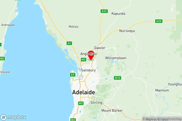
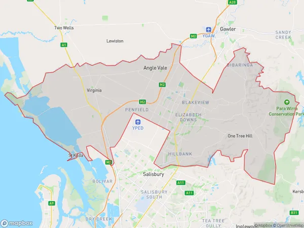
Playford Suburbs & Region, Playford Map & Postcodes
Playford Suburbs & Region, Playford Map & Postcodes in Playford, Adelaide North, SA, AU
Playford Region
Region Name
Playford (SA, AU)Playford Area
356.8 square kilometers (356.8 ㎢)Postal Codes
5112, 5113, from 5115 to 5118, 5120, and 5121 (In total, there are 8 postcodes in Playford.)Playford Introduction
Playford is a suburb of Adelaide located in the City of Charles Sturt. It is named after Sir John Playford, who was the Governor of South Australia from 1858 to 1862. Playford is located approximately 10 kilometers north of the Adelaide city center and is bordered by the suburbs of Elizabeth, Northfield, and Tea Tree Gully. The suburb has a population of around 20,000 people and is home to a variety of shops, restaurants, and recreational facilities. Playford has a strong sense of community and is known for its annual Playford Festival, which attracts thousands of visitors each year. The suburb also has a number of parks and reserves, including the Playford Lake Conservation Park and the Playford Park Golf Course. Playford is well-connected to the rest of Adelaide via the Port Road and the North East Road. It is also served by the Playford Bus Station, which provides frequent services to the city and surrounding areas.Australia State
City or Big Region
District or Regional Area
Playford Region Map

Playford Postcodes / Zip Codes
Playford Suburbs
Munno Para West Angle Vale
Virginia Waterloo Corner
Playford full address
Playford, Adelaide North, South Australia, SA, Australia, SaCode: 40202Country
Playford, Adelaide North, South Australia, SA, Australia, SaCode: 40202
Playford Suburbs & Region, Playford Map & Postcodes has 6 areas or regions above, and there are 48 Playford suburbs below. The sa3code for the Playford region is 40202. Its latitude and longitude coordinates are -34.6914,138.668.
Playford Suburbs & Localities
1. Elizabeth
2. Elizabeth East
3. Hillbank
4. Davoren Park
5. Edinburgh North
6. Elizabeth Downs
7. Buchfelde
8. Gawler Belt
9. Reid
10. Ward Belt
11. Willaston
12. Virginia
13. Penfield Gardens
14. Elizabeth Vale
15. Davoren Park North
16. Davoren Park South
17. Munno Para
18. Munno Para Downs
19. Munno Para West
20. Evanston Gardens
21. Bibaringa
22. Gawler River
23. Gawler South
24. Kangaroo Flat
25. Kingsford
26. Macdonald Park
27. Elizabeth Grove
28. Elizabeth South
29. Elizabeth North
30. Elizabeth Park
31. Elizabeth West Dc
32. Evanston Park
33. Evanston South
34. Hillier
35. Kalbeeba
36. Buckland Park
37. Penfield
38. Elizabeth West
39. Kudla
40. Evanston
41. Angle Vale
42. Concordia
43. Gawler
44. Gawler East
45. Gawler West
46. Hewett
47. Riverlea Park
48. Eyre
