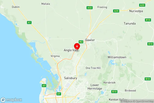
Munno Para West Angle Vale Suburbs & Region, Munno Para West Angle Vale Map & Postcodes
Munno Para West Angle Vale Suburbs & Region, Munno Para West Angle Vale Map & Postcodes in Munno Para West Angle Vale, Playford, Adelaide North, SA, AU
Munno Para West Angle Vale Region
Region Name
Munno Para West Angle Vale (SA, AU)Munno Para West Angle Vale Area
44.31 square kilometers (44.31 ㎢)Munno Para West Angle Vale Introduction
Munno Para West Angle Vale is a suburb of Adelaide in the Australian state of South Australia. It is located in the City of Charles Sturt and is part of the North Eastern Adelaide region. The suburb is named after the Munno Para Reservoir, which is located within its boundaries. The reservoir was built in the 1960s to provide water to the Adelaide plains. Munno Para West Angle Vale is a relatively new suburb, with most of the development occurring in the 1990s and 2000s. The suburb is characterized by a mix of residential and commercial properties, with several shopping centers and parks. The suburb is also home to several major employers, including the Royal Adelaide Hospital and the Australian Defence Force. The suburb has a diverse population, with a mix of different ethnic and cultural backgrounds. The majority of residents are of Australian descent, but there are also significant populations of Asian, African, and European descent. The suburb is known for its friendly community atmosphere and its many recreational facilities, including parks, walking trails, and sporting clubs. In conclusion, Munno Para West Angle Vale is a suburb of Adelaide that is characterized by a mix of residential and commercial properties, a diverse population, and a friendly community atmosphere. The suburb is home to several major employers and recreational facilities and is located in a convenient location with easy access to the city center.Australia State
City or Big Region
Greater Capital City
Greater Adelaide (4GADE)District or Regional Area
Suburb Name
Munno Para West Angle Vale Region Map

Munno Para West Angle Vale Suburbs
Munno Para West Angle Vale full address
Munno Para West Angle Vale, Playford, Adelaide North, South Australia, SA, Australia, SaCode: 402021032Country
Munno Para West Angle Vale, Playford, Adelaide North, South Australia, SA, Australia, SaCode: 402021032
Munno Para West Angle Vale Suburbs & Region, Munno Para West Angle Vale Map & Postcodes has 0 areas or regions above, and there are 0 Munno Para West Angle Vale suburbs below. The sa2code for the Munno Para West Angle Vale region is 402021032. Its latitude and longitude coordinates are -34.6472,138.678. Munno Para West Angle Vale area belongs to Australia's greater capital city Greater Adelaide.
