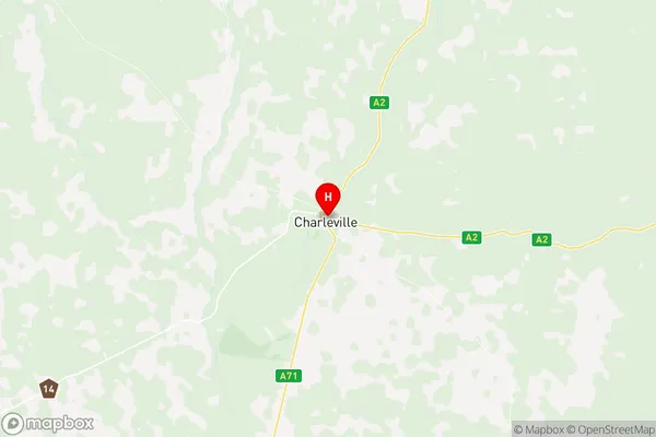
Charleville Suburbs & Region, Charleville Map & Postcodes
Charleville Suburbs & Region, Charleville Map & Postcodes in Charleville, Outback South, Queensland Outback, QLD, AU
Charleville Region
Region Name
Charleville (QLD, AU)Charleville Area
40700 square kilometers (40,700 ㎢)Postal Codes
4455, 4468, 4470, 4477, and 4479 (In total, there are 5 postcodes in Charleville.)Charleville Introduction
Charleville is a locality in the Maranoa Region, Queensland, Australia. It is one of the major gateways to the Outback from the Queensland coast. The town is located 556 kilometers west of Brisbane and 123 kilometers south-west of the regional capital, Roma. It is situated on the banks of the Warrego River. Charleville is a major hub for the surrounding pastoral industry, with a cattle station, a wool processing facility, and a grain storage and handling facility. The town has a population of around 2,000 people and is known for its historic buildings and museums. The Charleville Show is a major annual event in the town, attracting visitors from all over Queensland.Australia State
City or Big Region
Greater Capital City
Rest of Qld (3RQLD)District or Regional Area
Suburb Name
Charleville Region Map

Charleville Postcodes / Zip Codes
Charleville Suburbs
Charleville full address
Charleville, Outback South, Queensland Outback, Queensland, QLD, Australia, SaCode: 315031409Country
Charleville, Outback South, Queensland Outback, Queensland, QLD, Australia, SaCode: 315031409
Charleville Suburbs & Region, Charleville Map & Postcodes has 0 areas or regions above, and there are 17 Charleville suburbs below. The sa2code for the Charleville region is 315031409. Its latitude and longitude coordinates are -26.4021,146.245. Charleville area belongs to Australia's greater capital city Rest of Qld.
Charleville Suburbs & Localities
1. Angellala
2. Morven
3. Gowrie Station
4. Murweh
5. Ward
6. Augathella
7. Nive
8. Cooladdi
9. Bakers Bend
10. Sommariva
11. Caroline Crossing
12. Charleville
13. Langlo
14. Upper Warrego
15. Boatman
16. Clara Creek
17. Riversleigh
