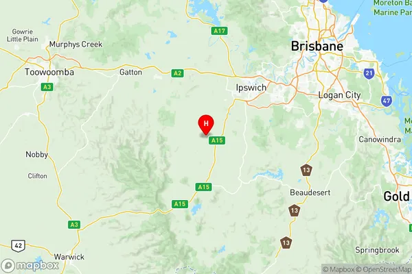
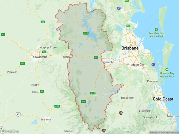
Ipswich Hinterland Suburbs & Region, Ipswich Hinterland Map & Postcodes
Ipswich Hinterland Suburbs & Region, Ipswich Hinterland Map & Postcodes in Ipswich Hinterland, Ipswich, QLD, AU
Ipswich Hinterland Region
Region Name
Ipswich Hinterland (QLD, AU)Ipswich Hinterland Area
6136 square kilometers (6,136 ㎢)Postal Codes
4307, 4309, 4310, 4312, 4340, 4341, 4346, and 4373 (In total, there are 8 postcodes in Ipswich Hinterland.)Ipswich Hinterland Introduction
Ipswich Hinterland is a locality in the City of Ipswich, Queensland, Australia. It is located 25 kilometers west of Ipswich's central business district. The area is known for its rural landscapes, including farms, forests, and scenic waterways. It is home to a number of historic sites, including the Ipswich Convict Barracks and the Old Windmill. The locality has a population of around 10,000 people and is a popular destination for tourists and locals alike.Australia State
City or Big Region
District or Regional Area
Ipswich Hinterland Region Map

Ipswich Hinterland Postcodes / Zip Codes
Ipswich Hinterland Suburbs
Southern Downs East
Ipswich Hinterland full address
Ipswich Hinterland, Ipswich, Queensland, QLD, Australia, SaCode: 31002Country
Ipswich Hinterland, Ipswich, Queensland, QLD, Australia, SaCode: 31002
Ipswich Hinterland Suburbs & Region, Ipswich Hinterland Map & Postcodes has 3 areas or regions above, and there are 104 Ipswich Hinterland suburbs below. The sa3code for the Ipswich Hinterland region is 31002. Its latitude and longitude coordinates are -27.7919,152.58.
Ipswich Hinterland Suburbs & Localities
1. Fassifern Valley
2. Kulgun
3. Milora
4. Coleyville
5. Harrisville
6. Warrill View
7. Wilsons Plains
8. Clumber
9. Fassifern
10. Allandale
11. Blantyre
12. Cannon Creek
13. Croftby
14. Lake Moogerah
15. Maroon Dam
16. Milbong
17. Mount Alford
18. Mount French
19. Wallaces Creek
20. Caboonbah
21. Coal Creek
22. Crossdale
23. Ashwell
24. Mount Walker West
25. Rosewood
26. Blenheim
27. Kensington Grove
28. Laidley Creek West
29. Laidley North
30. Mount Berryman
31. Townson
32. Moogerah
33. Morwincha
34. Mount Edwards
35. Obum Obum
36. Anthony
37. Bunjurgen
38. Dugandan
39. Hoya
40. Kents Pocket
41. Templin
42. Woolooman
43. Bryden
44. Eskdale
45. Moombra
46. Mount Hallen
47. Jeebropilly
48. Lanefield
49. Woolshed
50. Laidley Heights
51. The Head
52. The Falls
53. Aratula
54. Charlwood
55. Kents Lagoon
56. Teviotville
57. Washpool
58. Boonah
59. Burnett Creek
60. Coulson
61. Maroon
62. Mount Byron
63. Somerset Dam
64. Mutdapilly
65. Radford
66. Ebenezer
67. Lower Mount Walker
68. Merryvale
69. Mount Forbes
70. Mount Mort
71. Mount Walker
72. Rosevale
73. Hatton Vale
74. Kentville
75. Laidley
76. Mulgowie
77. Plainland
78. Silverdale
79. Frazerview
80. Kalbar
81. Munbilla
82. Tarome
83. Bunburra
84. Carneys Creek
85. Coochin
86. Frenches Creek
87. Milford
88. Roadvale
89. Wyaralong
90. Esk
91. Glen Esk
92. Murrumba
93. Redbank Creek
94. Calvert
95. Grandchester
96. Moorang
97. Tallegalla
98. The Bluff
99. Laidley South
100. Regency Downs
101. Summerholm
102. Thornton
103. Marburg
104. Killarney
