Melton Bacchus Marsh Suburbs & Region, Melton Bacchus Marsh Map & Postcodes
Melton Bacchus Marsh Suburbs & Region, Melton Bacchus Marsh Map & Postcodes in Melton Bacchus Marsh, Melbourne West, VIC, AU
Melton Bacchus Marsh Region
Region Name
Melton Bacchus Marsh (VIC, AU)Melton Bacchus Marsh Area
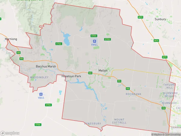
671.94 square kilometers (671.94 ㎢)Melton Bacchus Marsh Suburb Area Map (Polygon)
Melton Bacchus Marsh Introduction
Melton Bacchus Marsh is a locality in the local government area of the City of Melton, Victoria, Australia. It is located 29 km west of Melbourne's central business district. The post office opened as Bacchus Marsh on 1 November 1862 and was closed on 1 February 1974. The present post office opened as Melton West on 1 July 1976. The town is named after the Bacchus Marsh River, which flows through it. The river was named after the Roman god of wine, Bacchus. The town was originally settled by Europeans in the 1830s. The first settler was John Batman, who arrived in 1835. The town was developed as a farming community, with wheat being the main crop. The railway arrived in 1889, which helped to promote the town's growth. The town has a number of historic buildings, including the Bacchus Marsh Hotel, which was built in 1889. The hotel is a significant landmark in the town and is listed on the Victorian Heritage Register. The town also has a number of parks and reserves, including the Bacchus Marsh Reserve, which is a popular spot for picnics and walks. The town has a population of around 13,000 people and is a growing suburb. It is located in the Western GrowthAustralia State
City or Big Region
District or Regional Area
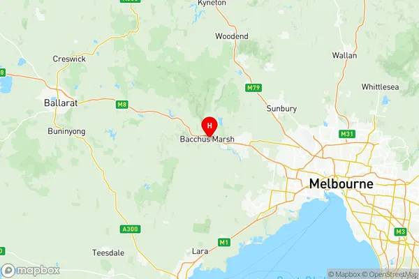
Melton Bacchus Marsh Region Map
Melton Bacchus Marsh Suburbs
Rockbank Mount Cottrell
Burnside Heights
Caroline Springs
Cobblebank Strathtulloh
Eynesbury Exford
Fraser Rise Plumpton
Kurunjang Toolern Vale
Melton South Weir Views
Melton Bacchus Marsh full address
Melton Bacchus Marsh, Melbourne West, Victoria, VIC, Australia, SaCode: 21304Country
Melton Bacchus Marsh, Melbourne West, Victoria, VIC, Australia, SaCode: 21304
Melton Bacchus Marsh Suburbs & Region, Melton Bacchus Marsh Map & Postcodes has 22 areas or regions above, and there are 0 Melton Bacchus Marsh suburbs below. The sa3code for the Melton Bacchus Marsh region is 21304. Its latitude and longitude coordinates are -37.6764,144.446.