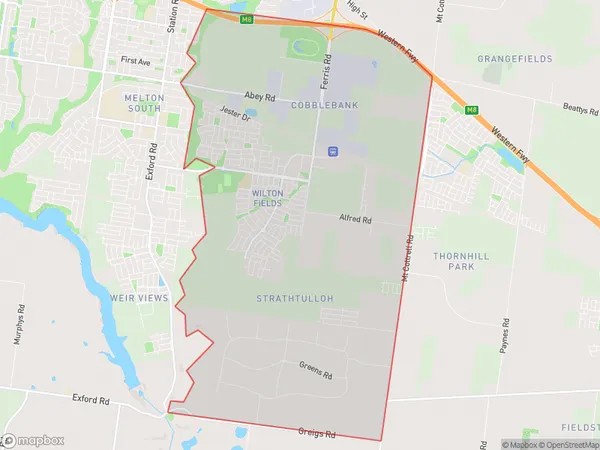
Cobblebank Strathtulloh Suburbs & Region, Cobblebank Strathtulloh Map & Postcodes
Cobblebank Strathtulloh Suburbs & Region, Cobblebank Strathtulloh Map & Postcodes in Cobblebank Strathtulloh, Melton Bacchus Marsh, Melbourne West, VIC, AU
Cobblebank Strathtulloh Region
Region Name
Cobblebank Strathtulloh (VIC, AU)Cobblebank Strathtulloh Area
19.76 square kilometers (19.76 ㎢)Cobblebank Strathtulloh Introduction
Cobblebank Strathtulloh is a locality in Melbourne, Victoria, Australia. It is located in the City of Melton local government area. The post office opened as Strathtulloh on 1 July 1891 and was closed on 1 October 1975. The name was changed to Cobblebank on 1 July 1977. Cobblebank is a residential suburb with a mix of housing types, including single-detached houses, units, and apartments. It has a variety of shops and services, including a supermarket, post office, and medical center. The suburb is also home to several parks and recreational facilities, including a cricket club, tennis courts, and a basketball court. Cobblebank is well-connected to other parts of Melbourne, with easy access to the Western Ring Road and the Melbourne CBD. It is also located near several schools, including St Mary's Primary School and St John Paul II College.Australia State
City or Big Region
Greater Capital City
Greater Melbourne (2GMEL)District or Regional Area
Suburb Name
Cobblebank Strathtulloh Suburbs
Cobblebank Strathtulloh full address
Cobblebank Strathtulloh, Melton Bacchus Marsh, Melbourne West, Victoria, VIC, Australia, SaCode: 213041572Country
Cobblebank Strathtulloh, Melton Bacchus Marsh, Melbourne West, Victoria, VIC, Australia, SaCode: 213041572
Cobblebank Strathtulloh Suburbs & Region, Cobblebank Strathtulloh Map & Postcodes has 0 areas or regions above, and there are 0 Cobblebank Strathtulloh suburbs below. The sa2code for the Cobblebank Strathtulloh region is 213041572. Cobblebank Strathtulloh area belongs to Australia's greater capital city Greater Melbourne.
