Wangaratta Benalla Suburbs & Region, Wangaratta Benalla Map & Postcodes
Wangaratta Benalla Suburbs & Region, Wangaratta Benalla Map & Postcodes in Wangaratta Benalla, Hume, VIC, AU
Wangaratta Benalla Region
Region Name
Wangaratta Benalla (VIC, AU)Wangaratta Benalla Area
6546 square kilometers (6,546 ㎢)Postal Codes
3666, from 3670 to 3673, 3676, 3677, 3682, 3687, 3720, 3725, 3726, 3732, 3733, 3735, and 3746 (In total, there are 16 postcodes in Wangaratta Benalla.)Wangaratta Benalla Suburb Area Map (Polygon)

Wangaratta Benalla Introduction
Wangaratta Benalla is a town in north-east Victoria, Australia. It is located on the Wangaratta River, 145 km north-east of Melbourne, and 115 km south-west of the state capital, Melbourne. The town has a population of around 20,000 people and is the administrative center of the Wangaratta Rural City Council. Wangaratta Benalla is known for its historic buildings, including the Wangaratta Courthouse, which is listed on the Victorian Heritage Register. The town is also home to a number of wineries and vineyards, and is a popular tourist destination. The town has a number of schools, including Wangaratta High School, Wangaratta Primary School, and St John's College. The town also has a hospital, a library, and a number of shopping centers.Australia State
City or Big Region
District or Regional Area
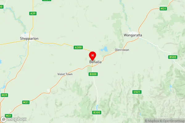
Wangaratta Benalla Region Map
Wangaratta Benalla Postcodes / Zip Codes
Wangaratta Benalla Suburbs
Seymour Region
Wangaratta Benalla full address
Wangaratta Benalla, Hume, Victoria, VIC, Australia, SaCode: 20402Country
Wangaratta Benalla, Hume, Victoria, VIC, Australia, SaCode: 20402
Wangaratta Benalla Suburbs & Region, Wangaratta Benalla Map & Postcodes has 3 areas or regions above, and there are 71 Wangaratta Benalla suburbs below. The sa3code for the Wangaratta Benalla region is 20402. Its latitude and longitude coordinates are -36.5462,145.963.
Wangaratta Benalla Suburbs & Localities
1. Kithbrook
2. Miepoll
3. Riggs Creek
4. Sheans Creek
5. Tarcombe
6. Baddaginnie
7. Tarnook
8. Lima
9. Lima East
10. Lurg
11. Moorngag
12. Tatong
13. Upotipotpon
14. Winton North
15. Wangaratta
16. Appin Park
17. Wangaratta West
18. Norong
19. Carlyle
20. Creighton
21. Gooram
22. Moglonemby
23. Pranjip
24. Strathbogie
25. Benalla
26. Benalla West
27. Broken Creek
28. Goomalibee
29. Lake Mokoan
30. Molyullah
31. Wangaratta
32. Yarrunga
33. Boralma
34. Lilliput
35. Springhurst
36. Chesney Vale
37. Goorambat
38. Moyhu
39. Whorouly
40. Stewarton
41. Bungeet
42. Balmattum
43. Euroa
44. Kelvin View
45. Longwood East
46. Kilfeera
47. Samaria
48. Upper Lurg
49. Winton
50. Wahgunyah
51. Creightons Creek
52. Molka
53. Ruffy
54. Warrenbayne
55. Benalla
56. Benalla
57. Lima South
58. Swanpool
59. Upper Ryans Creek
60. Major Plains
61. Thoona
62. Bowmans Forest
63. Whorouly East
64. Whorouly South
65. Bonnie Doon
66. Boxwood
67. Bungeet West
68. Devenish
69. Myrrhee
70. Whitfield
71. Eldorado