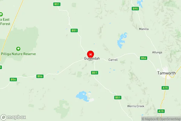
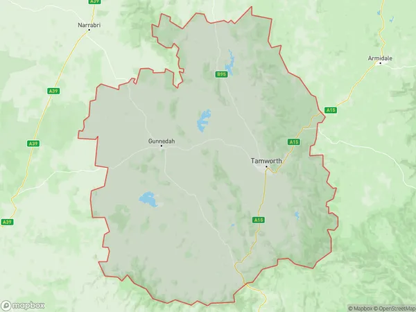
Tamworth Gunnedah Suburbs & Region, Tamworth Gunnedah Map & Postcodes
Tamworth Gunnedah Suburbs & Region, Tamworth Gunnedah Map & Postcodes in Tamworth Gunnedah, New England and North West, NSW, AU
Tamworth Gunnedah Region
Region Name
Tamworth Gunnedah (NSW, AU)Tamworth Gunnedah Area
20155 square kilometers (20,155 ㎢)Postal Codes
from 2338 to 2347, from 2352 to 2355, from 2379 to 2382, and 2390 (In total, there are 19 postcodes in Tamworth Gunnedah.)Tamworth Gunnedah Introduction
Tamworth Gunnedah, New England and North West, New South Wales, AU, is a major regional center in the New England region of New South Wales. It is located in the Tamworth Regional Council area and had a population of 31,199 at the 2016 census. The town is known for its agriculture, particularly sheep and wheat farming, and is also a major transport hub, with the railway line passing through it. The city has a number of historic buildings and landmarks, including the Tamworth Regional Gallery and the Tamworth Power Station. It is also home to a number of festivals and events, including the Tamworth Country Music Festival and the Tamworth Show.Australia State
City or Big Region
District or Regional Area
Tamworth Gunnedah Region Map

Tamworth Gunnedah Postcodes / Zip Codes
Tamworth Gunnedah Suburbs
Tamworth Gunnedah full address
Tamworth Gunnedah, New England and North West, New South Wales, NSW, Australia, SaCode: 11004Country
Tamworth Gunnedah, New England and North West, New South Wales, NSW, Australia, SaCode: 11004
Tamworth Gunnedah Suburbs & Region, Tamworth Gunnedah Map & Postcodes has 11 areas or regions above, and there are 173 Tamworth Gunnedah suburbs below. The sa3code for the Tamworth Gunnedah region is 11004. Its latitude and longitude coordinates are -30.9923,150.237.
Tamworth Gunnedah Suburbs & Localities
1. Timor
2. Little Jacks Creek
3. Parraweena
4. Willow Tree
5. Barry
6. Calala
7. Dungowan
8. Gidley
9. Hallsville
10. Moore Creek
11. Wallamore
12. West Tamworth
13. Blackville
14. Quirindi
15. Duri
16. Garthowen
17. Borah Creek
18. Halls Creek
19. Gulf Creek
20. Ironbark
21. Lindesay
22. Red Hill
23. Woodsreef
24. Moona Plains
25. Niangala
26. Retreat
27. Goolhi
28. Mullaley
29. Blue Vale
30. Gunnembene
31. Noggabri
32. Breeza
33. Premer
34. Pullaming
35. Tambar Springs
36. Couradda
37. Edgeroi
38. Harparary
39. Kaputar
40. Narrabri
41. Crawney
42. Murrurundi
43. Pages River
44. Scotts Creek
45. Cattle Creek
46. Chilcotts Creek
47. Macdonalds Creek
48. Bective
49. Bithramere
50. Duncans Creek
51. Garoo
52. Goonoo Goonoo
53. Gowrie
54. Loomberah
55. Nundle
56. Somerton
57. Timbumburi
58. Werris Creek
59. Borambil
60. Bundella
61. Coomoo Coomoo
62. Wallabadah
63. Windy
64. Winton
65. Attunga
66. Klori
67. New Mexico
68. Warrabah
69. Cobbadah
70. Gundamulda
71. Horton Valley
72. Longarm
73. Mulla Creek
74. Walcha
75. Wollun
76. Woolbrook
77. Big Jacks Creek
78. Braefield
79. Warrah Creek
80. Appleby
81. Carroll
82. East Tamworth
83. Hanging Rock
84. Hillvue
85. North Tamworth
86. Ogunbil
87. Oxley Vale
88. Piallamore
89. South Tamworth
90. Weabonga
91. Westdale
92. Woolomin
93. Piallaway
94. Caroona
95. Colly Blue
96. Walhallow
97. Warrah Ridge
98. Yarraman
99. Manilla
100. Rushes Creek
101. Upper Manilla
102. Barraba
103. Caroda
104. Thirloene
105. Kootingal
106. Tintinhull
107. Moonbi
108. Branga Plains
109. Kentucky
110. Kentucky South
111. Nowendoc
112. Walcha Road
113. Yarrowitch
114. Watsons Creek
115. Basin Plain
116. Burburgate
117. Coocooboonah
118. Ghoolendaadi
119. Milroy
120. Orange Grove
121. Nea
122. Boggabri
123. Eulah Creek
124. Turrawan
125. Napier Lane
126. Nombi
127. Emerald Hill
128. Marys Mount
129. Rangari
130. Curlewis
131. Maules Creek
132. Wean
133. Baan Baa
134. Back Creek
135. Berrigal
136. Bullawa Creek
137. Tarriaro
138. Ardglen
139. Blandford
140. Green Creek
141. Sandy Creek
142. Warrah
143. Bowling Alley Point
144. Daruka
145. Keepit
146. Kingswood
147. Nemingha
148. Taminda
149. Tamworth
150. Tamworth South
151. Warral
152. Currabubula
153. Pine Ridge
154. Quipolly
155. Spring Ridge
156. Yannergee
157. Namoi River
158. Wimborne
159. Wongo Creek
160. Banoon
161. Mayvale
162. Upper Horton
163. Limbri
164. Upper Yarrowitch
165. Bendemeer
166. Gunnedah
167. Kelvin
168. Meermaul
169. Willala
170. Bohena Creek
171. Jacks Creek
172. Narrabri West
173. Rocky Creek
