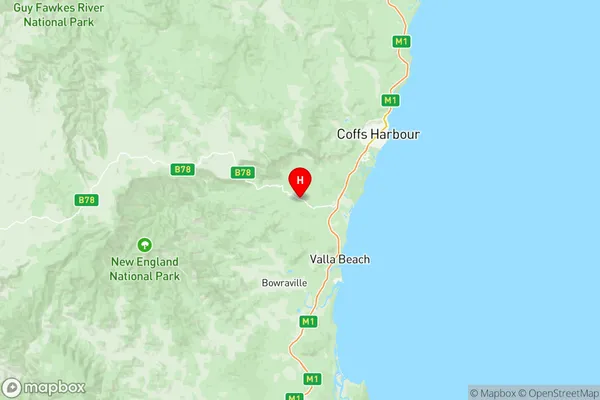
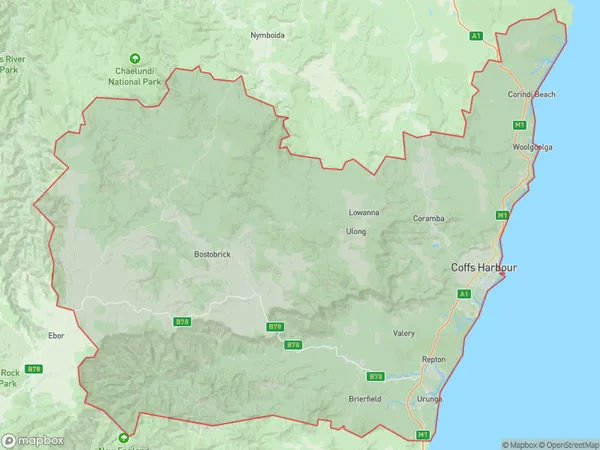
Coffs Harbour Suburbs & Region, Coffs Harbour Map & Postcodes
Coffs Harbour Suburbs & Region, Coffs Harbour Map & Postcodes in Coffs Harbour, Coffs Harbour Grafton, NSW, AU
Coffs Harbour Region
Region Name
Coffs Harbour (NSW, AU)Coffs Harbour Area
3967 square kilometers (3,967 ㎢)Postal Codes
2450, 2452, and from 2454 to 2456 (In total, there are 5 postcodes in Coffs Harbour.)Coffs Harbour Introduction
Coffs Harbour is a city in New South Wales, Australia, located on the mid-north coast of the state. It is known for its beautiful beaches, lush forests, and vibrant cultural scene. The city is home to a large population of retirees and is a popular tourist destination. It is also a major hub for the fishing industry, with a port that is one of the largest in the country. Coffs Harbour is surrounded by stunning natural scenery, including the Mount Warning National Park and the Dorrigo National Park. The city has a variety of attractions, including a museum, a theater, a casino, and a variety of shopping centers. It is also home to a number of festivals and events, including the Coffs Harbour Jazz Festival and the Coffs Harbour Carnival.Australia State
City or Big Region
District or Regional Area
Coffs Harbour Region Map

Coffs Harbour Postcodes / Zip Codes
Coffs Harbour Suburbs
Coffs Harbour North
Coffs Harbour South
Coramba Nana Glen Bucca
Korora Emerald Beach
Coffs Harbour full address
Coffs Harbour, Coffs Harbour Grafton, New South Wales, NSW, Australia, SaCode: 10402Country
Coffs Harbour, Coffs Harbour Grafton, New South Wales, NSW, Australia, SaCode: 10402
Coffs Harbour Suburbs & Region, Coffs Harbour Map & Postcodes has 7 areas or regions above, and there are 60 Coffs Harbour suburbs below. The sa3code for the Coffs Harbour region is 10402. Its latitude and longitude coordinates are -30.4522,152.898.
Coffs Harbour Suburbs & Localities
1. Coffs Harbour
2. Coffs Harbour Dc
3. Coffs Harbour Plaza
4. Glenreagh
5. Boambee East
6. Brierfield
7. Darkwood
8. Fernmount
9. Thora
10. Boambee
11. Bonville
12. Brooklana
13. Bucca
14. Sapphire Beach
15. Valery
16. Gleniffer
17. Hydes Creek
18. Orama
19. Raleigh
20. Scotchman
21. Spicketts Creek
22. Tarkeeth
23. Urunga
24. Arrawarra
25. Red Rock
26. Dairyville
27. Lowanna
28. Lower Bucca
29. Nana Glen
30. Toormina
31. Coffs Harbour Jetty
32. Coramba
33. Karangi
34. Korora
35. Moonee Beach
36. North Boambee Valley
37. Sherwood
38. Ulong
39. Upper Orara
40. Bayldon
41. Sawtell
42. Bundagen
43. Gordonville
44. Repton
45. Sunny Corner
46. Upper Thora
47. Arrawarra Headland
48. Corindi Beach
49. Dirty Creek
50. Mullaway
51. Safety Beach
52. Upper Corindi
53. Bellingen
54. Brinerville
55. Kalang
56. Kooroowi
57. Mylestom
58. Emerald Beach
59. Sandy Beach
60. Woolgoolga
