Hauraki Suburbs & Region, Hauraki Map & Postcodes in Hauraki, Waikato
Hauraki Postcodes, Hauraki ZipCodes, Hauraki , Hauraki Waikato, Hauraki Suburbs, Hauraki Region, Hauraki Map, Hauraki Area
Hauraki Region
Hauraki Suburbs
Hauraki is a district place type in Waikato, NZ. It contains 12 suburbs or localities.Hauraki district
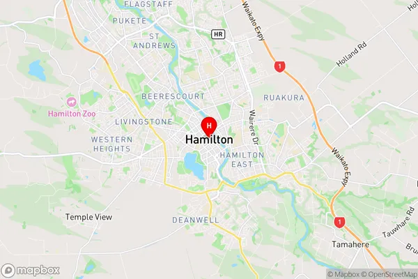
HaurakiHauraki Region Map
Hauraki Introduction
Hauraki is a district in the Waikato region of New Zealand's North Island. It is situated on the Hauraki Gulf and is home to the cities of Hamilton, Tauranga, and Mount Maunganui. The district has a rich history and is known for its stunning natural beauty, including the Bay of Islands, Mount Maunganui, and the Hauraki Plains. It is also home to a number of popular tourist attractions, including the Waikato Museum, the Hamilton Gardens, and the Tauranga Harbor.Hauraki Region
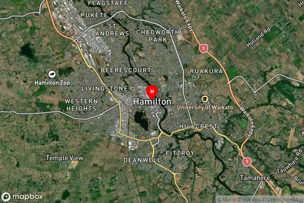
Hauraki Satellite Map
Full Address
Hauraki, WaikatoHauraki Coordinates
-37.7878809,175.281788 (Latitude / Longitude)Hauraki Map in NZ
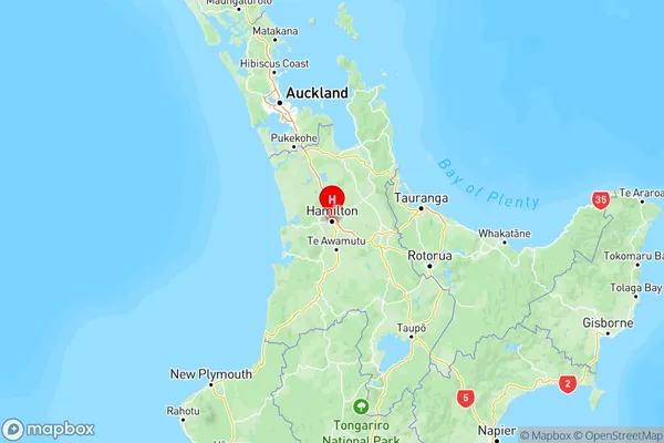
NZ Island
North IslandCountry
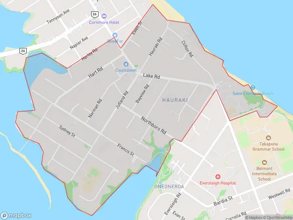
Hauraki Area Map (Polygon)
Name
HaurakiAdditional Name
Local Authority
Auckland
Hauraki Suburbs (Sort by Population)
Hauraki suburb has around
1.7 square
kilometers.There are more than 4606 people (estimated)
live in Hauraki, Devonport-Takapuna, Auckland, New Zealand.
Hauraki Suburbs (Sort in alphabetical)
Hauraki Surrounds
Kaihere
Karangahake
Kerepehi
Mangatarata
Ngatea
Paeroa
Pipiroa
Turua
Waihi
Waikino
Waitakaruru