Waimate Suburbs & Region, Waimate Map & Postcodes in Waimate, Waimate, Canterbury
Waimate Postcodes, Waimate ZipCodes, Waimate , Waimate Canterbury, Waimate Suburbs, Waimate Region, Waimate Map, Waimate Area
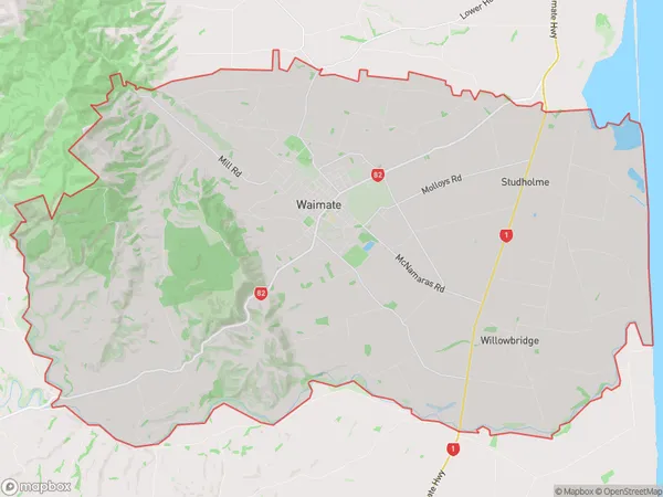
Waimate Region (Arno, Kapua, Maytown, Norton Reserve, Nukuroa, Studholme, Studholme Junction, Te Waimate, Uretane, Waituna, Willowbridge Region)
Waimate Suburbs
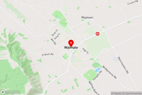
Waimate is a suburb place type in Waimate, Canterbury, NZ. It contains 9 suburbs or localities.Waimate Region Map
Waimate Introduction
Waimate is a town in the North Canterbury region of New Zealand's South Island. It is located on the Waimate River, 120 km northwest of Christchurch, and is the administrative center of the Waimate District. The town has a population of around 3,500 people and is known for its agricultural industry, particularly sheep farming. Waimate also has a historic woolen mill, which is a popular tourist attraction. The town is surrounded by scenic countryside, including the Waimate Forest Park, and is a popular destination for outdoor activities such as hiking, skiing, and fishing.Waimate Region
Waimate City
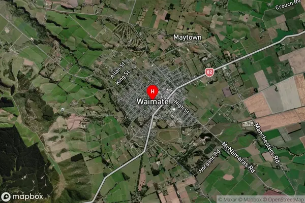
Waimate Satellite Map
Full Address
Waimate, Waimate, CanterburyWaimate Coordinates
-44.733881,171.042339 (Latitude / Longitude)Waimate Map in NZ
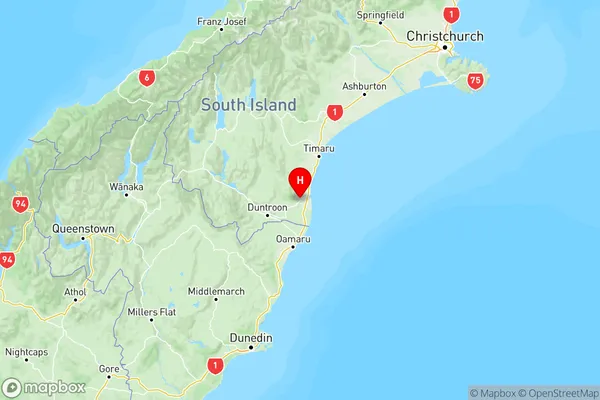
NZ Island
South IslandCountry
Waimate Area Map (Polygon)
Name
WaimateAdditional Name
Arno, Kapua, Maytown, Norton Reserve, Nukuroa, Studholme, Studholme Junction, Te Waimate, Uretane, Waituna, WillowbridgeLocal Authority
Waimate District
Waimate Suburbs (Sort by Population)
Waimate
Waimate - 4503Glenavy
Glenavy - 415Morven
Morven - 378Makikihi
Makikihi - 378Ikawai
Ikawai - 332Elephant Hill
Elephant Hill - 137Hunter
Hunter - 103Waihao Downs
Waihao Downs - 101Waihaorunga
Waihaorunga - 92