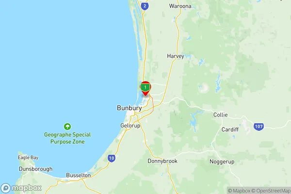
Bunbury Suburbs & Region, Bunbury Map & Postcodes
Bunbury Suburbs & Region, Bunbury Map & Postcodes in Bunbury, WA, AU
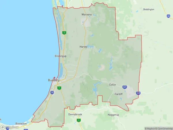
Bunbury Region
Region Name
Bunbury (WA, AU)Bunbury Area
5450 square kilometers (5,450 ㎢)Postal Codes
from 6218 to 6221, 6223, 6224, from 6226 to 6233, 6236, 6237, 6271, and 6280 (In total, there are 18 postcodes in Bunbury.)Bunbury Introduction
Bunbury is a city in the Southwest region of Western Australia, 200 kilometers south of Perth, the state capital. It is the administrative center of the Bunbury Region and is located on the southern shore of the Bunbury Port. The city had a population of 47,163 at the 2016 census. Bunbury is known for its beaches, including the popular Bunbury Beach and City Beach. It is also home to the Bunbury Regional Art Gallery, the Bunbury Regional Museum, and the Bunbury Cathedral. The city is a major agricultural hub, with a large number of farms and wineries in the surrounding area. Bunbury is also a popular tourist destination, with many visitors coming to enjoy the city's beaches, museums, and cultural attractions. The city is home to a number of festivals and events, including the Bunbury Farmers Market, the Bunbury Music Festival, and the Bunbury Show.Australia State
City or Big Region
District or Regional Area
Bunbury Region Map

Bunbury Postcodes / Zip Codes
Bunbury Suburbs
Australind Leschenault
College Grove Carey Park
Eaton Pelican Point
East Bunbury Glen Iris
Gelorup Stratham
South Bunbury Bunbury
Withers Usher
Bunbury full address
Bunbury, Western Australia, WA, Australia, SaCode: 50102Country
Bunbury, Western Australia, WA, Australia, SaCode: 50102
Bunbury Suburbs & Region, Bunbury Map & Postcodes has 13 areas or regions above, and there are 92 Bunbury suburbs below. The sa3code for the Bunbury region is 50102. Its latitude and longitude coordinates are -33.2751,115.729.
Bunbury Suburbs & Localities
1. Hoffman
2. Uduc
3. Yarloop
4. Harvey
5. Waterloo
6. Carey Park
7. Dalyellup
8. East Bunbury
9. Pelican Point
10. South Bunbury
11. Usher
12. Bunbury
13. Eaton
14. Wellesley
15. Dardanup West
16. Henty
17. Wellington Mill
18. Peppermint Grove Beach
19. Broadwater
20. Geographe
21. Hithergreen
22. Kalgup
23. Metricup
24. Reinscourt
25. Siesta Park
26. Wilyabrup
27. Myalup
28. Mornington
29. Wokalup
30. Benger
31. Beela
32. Roelands
33. Davenport
34. Withers
35. Millbridge
36. Dardanup
37. Elgin
38. Capel River
39. Forrest Beach
40. Abbey
41. Acton Park
42. Ambergate
43. Anniebrook
44. Bovell
45. Marybrook
46. North Jindong
47. Ruabon
48. Yelverton
49. Cookernup
50. Warawarrup
51. Brunswick
52. Burekup
53. Picton
54. College Grove
55. Binningup
56. Leschenault
57. Crooked Brook
58. Ferguson
59. Stratham
60. The Plains
61. Picton East
62. Bunbury
63. Stirling Estate
64. Boallia
65. Kalgup
66. Ludlow
67. Sabina River
68. Tutunup
69. Vasse
70. Walsall
71. West Busselton
72. Yoongarillup
73. Gelorup
74. Glen Iris
75. Vittoria
76. Australind
77. Parkfield
78. Paradise
79. Wellington Forest
80. Boyanup
81. Gwindinup
82. North Boyanup
83. Capel
84. Abba River
85. Busselton
86. Carbunup River
87. Chapman Hill
88. Jindong
89. Kaloorup
90. Kealy
91. Wonnerup
92. Yalyalup
