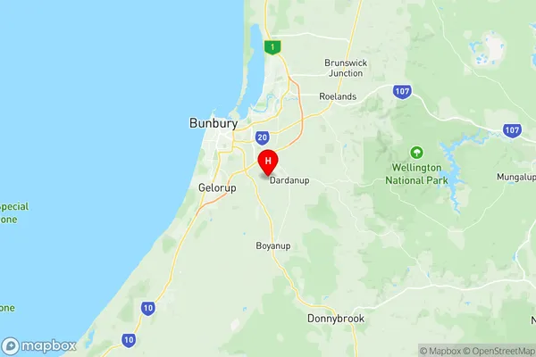
Dardanup Suburbs & Region, Dardanup Map & Postcodes
Dardanup Suburbs & Region, Dardanup Map & Postcodes in Dardanup, Bunbury, WA, AU
Dardanup Region
Region Name
Dardanup (WA, AU)Dardanup Area
517.08 square kilometers (517.08 ㎢)Postal Codes
from 6227 to 6229, and 6236 (In total, there are 4 postcodes in Dardanup.)Dardanup Introduction
Dardanup is a suburb of the City of Bunbury in Western Australia, 20 kilometers south of Bunbury's central business district. It is part of the City of Bunbury local government area. The suburb takes its name from the Dardanup River, which flows through it. The river is a major source of water for the region and is home to a variety of wildlife, including fish, birds, and mammals. The suburb has a number of parks and recreational facilities, including a golf course, a swimming pool, and a skate park. It is also home to a number of schools, including Dardanup Primary School and Bunbury Catholic College. The suburb is a popular residential area with a mix of single-family homes and apartments. It is located close to the beach and the Bunbury Regional Hospital.Australia State
City or Big Region
Greater Capital City
Rest of WA (5RWAU)District or Regional Area
Suburb Name
Dardanup Region Map

Dardanup Postcodes / Zip Codes
Dardanup Suburbs
Dardanup full address
Dardanup, Bunbury, Western Australia, WA, Australia, SaCode: 501021010Country
Dardanup, Bunbury, Western Australia, WA, Australia, SaCode: 501021010
Dardanup Suburbs & Region, Dardanup Map & Postcodes has 0 areas or regions above, and there are 11 Dardanup suburbs below. The sa2code for the Dardanup region is 501021010. Its latitude and longitude coordinates are -33.398,115.721. Dardanup area belongs to Australia's greater capital city Rest of WA.
Dardanup Suburbs & Localities
1. Waterloo
2. Dardanup West
3. Henty
4. Wellington Mill
5. Dardanup
6. Burekup
7. Crooked Brook
8. Ferguson
9. Picton East
10. Paradise
11. Wellington Forest
