Darling Downs East Suburbs & Region, Darling Downs East Map & Postcodes
Darling Downs East Suburbs & Region, Darling Downs East Map & Postcodes in Darling Downs East, Darling Downs Maranoa, QLD, AU
Darling Downs East Region
Region Name
Darling Downs East (QLD, AU)Darling Downs East Area
16653 square kilometers (16,653 ㎢)Postal Codes
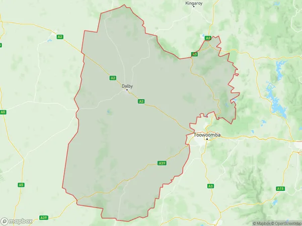
from 4353 to 4357, 4363, 4364, from 4401 to 4404, from 4406 to 4408, 4410, and 4411 (In total, there are 16 postcodes in Darling Downs East.)Darling Downs East Suburb Area Map (Polygon)
Darling Downs East Introduction
Darling Downs East is a locality in the Darling Downs Region, Queensland, Australia. It is one of the major gateways to the Darling Downs from the Queensland coast and is located approximately 135 km west of Brisbane. The locality is named after the Darling Downs, which are a series of low hills that run through the region. The town has a population of around 2,000 people and is a major agricultural hub, with cotton, wheat, and grazing being the main industries. The town also has a primary school, a post office, a general store, and a hospital. The Darling Downs East railway line passes through the locality, providing transport to Brisbane and other major towns in Queensland. The town is also home to the Darling Downs East State School, which was established in 1922.Australia State
City or Big Region
District or Regional Area
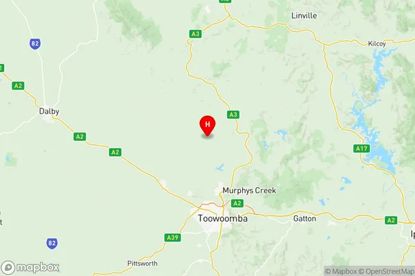
Darling Downs East Region Map
Darling Downs East Postcodes / Zip Codes
Darling Downs East Suburbs
Darling Downs East full address
Darling Downs East, Darling Downs Maranoa, Queensland, QLD, Australia, SaCode: 30702Country
Darling Downs East, Darling Downs Maranoa, Queensland, QLD, Australia, SaCode: 30702
Darling Downs East Suburbs & Region, Darling Downs East Map & Postcodes has 4 areas or regions above, and there are 129 Darling Downs East suburbs below. The sa3code for the Darling Downs East region is 30702. Its latitude and longitude coordinates are -27.2771,151.893.
Darling Downs East Suburbs & Localities
1. Crows Nest
2. Glenaven
3. Nukinenda
4. Pierces Creek
5. Sylvia Vale
6. The Bluff
7. Bongeen
8. Clontarf
9. Cypress Gardens
10. Domville
11. Forest Ridge
12. Douglas
13. Cressbrook Creek
14. Genaven
15. Glenhaven
16. Broxburn
17. Evanslea
18. Irongate
19. St Helens
20. Bringalily
21. Canning Creek
22. Lemontree
23. Millwood
24. Punchs Creek
25. The Pines
26. Western Creek
27. Brookstead
28. East Cooyar
29. Mount Darry
30. Goombungee
31. Kilbirnie
32. Anduramba
33. Emu Creek
34. Jones Gully
35. Mountain Camp
36. Plainby
37. Linthorpe
38. Mount Tyson
39. North Branch
40. Pittsworth
41. Rossvale
42. Scrubby Mountain
43. Stoneleigh
44. Yarranlea
45. Captains Mountain
46. Condamine Farms
47. Grays Gate
48. Millmerran
49. Millmerran Woods
50. Mount Emlyn
51. Rocky Creek
52. Turallin
53. Wattle Ridge
54. Woondul
55. Bergen
56. Haden
57. Pierce Creek
58. Pinelands
59. Upper Pinelands
60. Kincora
61. Motley
62. Norwin
63. Purrawunda
64. Springside
65. Bulli Creek
66. Kooroongarra
67. Lavelle
68. Millmerran Downs
69. Stonehenge
70. Southbrook
71. Acland
72. Kings Siding
73. Silverleigh
74. Jondaryan
75. Mount Moriah
76. Halliford
77. Hannaford
78. Jimbour
79. Burra Burri
80. Jinghi
81. Aubigny
82. Balgowan
83. Boodua
84. Highland Plains
85. Mount Irving
86. Muldu
87. Cooyar
88. Upper Cooyar Creek
89. Malu
90. Quinalow
91. Boondandilla
92. Jimbour East
93. Moonie
94. Southwood
95. The Gums
96. Weir River
97. Cecil Plains
98. Dunmore
99. Diamondy
100. Jandowae
101. Langlands
102. Tuckerang
103. Biddeston
104. Greenwood
105. Oakey
106. Yargullen
107. Kooralgin
108. Brymaroo
109. West Prairie
110. Bowenville
111. Moola
112. Nangwee
113. Bell
114. Devon Park
115. Kelvinhaugh
116. Rosalie Plains
117. Sabine
118. Formartin
119. Irvingdale
120. Wainui
121. Jimbour West
122. Kaimkillenbun
123. Kogan
124. Macalister
125. Cattle Creek
126. Cooranga
127. Cooranga North
128. Darr Creek
129. Warra