Crows Nest Rosalie Suburbs & Region, Crows Nest Rosalie Map & Postcodes
Crows Nest Rosalie Suburbs & Region, Crows Nest Rosalie Map & Postcodes in Crows Nest Rosalie, Darling Downs East, Darling Downs Maranoa, QLD, AU
Crows Nest Rosalie Region
Region Name
Crows Nest Rosalie (QLD, AU)Crows Nest Rosalie Area
3251 square kilometers (3,251 ㎢)Postal Codes
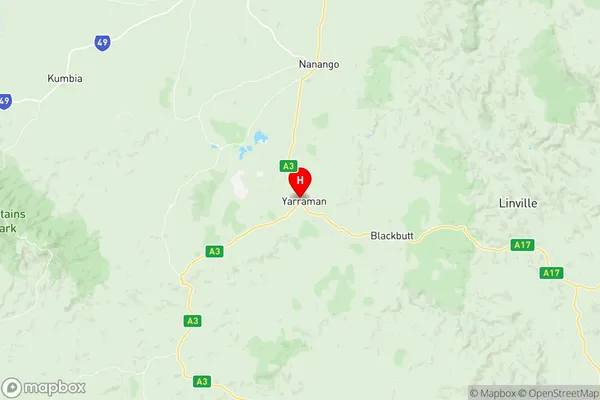
4306, 4314, from 4352 to 4355, from 4401 to 4403, and 4614 (In total, there are 10 postcodes in Crows Nest Rosalie.)Crows Nest Rosalie Suburb Area Map (Polygon)

Crows Nest Rosalie Introduction
Crows Nest Rosalie is a locality in the Darling Downs Region, Queensland, Australia. It is one of the major gateways to the Surat Basin from the Darling Downs. The town is named after Rosalie, the wife of the founder of the town, John McDougall. Crows Nest is a small town with a population of around 2,000 people. It is located in the Maranoa Shire and is situated approximately 225 kilometers west of Brisbane. The town has a primary school, a post office, a general store, a hotel, and a petrol station. The surrounding area is known for its agricultural productivity, with cotton, wheat, and chickpeas being the major crops grown. The town is also home to a number of mining operations, including coal and gas.Australia State
City or Big Region
Greater Capital City
Rest of Qld (3RQLD)District or Regional Area
Suburb Name
Crows Nest Rosalie Region Map
Crows Nest Rosalie Postcodes / Zip Codes
Crows Nest Rosalie Suburbs
Crows Nest Rosalie full address
Crows Nest Rosalie, Darling Downs East, Darling Downs Maranoa, Queensland, QLD, Australia, SaCode: 307021179Country
Crows Nest Rosalie, Darling Downs East, Darling Downs Maranoa, Queensland, QLD, Australia, SaCode: 307021179
Crows Nest Rosalie Suburbs & Region, Crows Nest Rosalie Map & Postcodes has 0 areas or regions above, and there are 78 Crows Nest Rosalie suburbs below. The sa2code for the Crows Nest Rosalie region is 307021179. Its latitude and longitude coordinates are -26.8392,151.977. Crows Nest Rosalie area belongs to Australia's greater capital city Rest of Qld.
Crows Nest Rosalie Suburbs & Localities
1. Cherry Creek
2. Coalbank
3. Djuan
4. Doctor Creek
5. Grapetree
6. Highgrove
7. Malling
8. Merritts Creek
9. North Maclagan
10. Grape Tree
11. Hampton
12. Mount Luke
13. Muniganeen
14. Palmtree
15. Perseverance
16. Ravensbourne
17. Woodleigh
18. Wutul
19. Crows Nest
20. Glenaven
21. Nukinenda
22. Pierces Creek
23. Sylvia Vale
24. The Bluff
25. Thornville
26. Douglas
27. Cressbrook Creek
28. Genaven
29. Glenhaven
30. Googa Creek
31. Mount Binga
32. Cherry Creek
33. Gilla
34. Googa Creek
35. Evergreen
36. Narko
37. Palm Tree
38. Pechey
39. St Aubyn
40. Mount Binga
41. East Cooyar
42. Mount Darry
43. Goombungee
44. Kilbirnie
45. Anduramba
46. Emu Creek
47. Jones Gully
48. Mountain Camp
49. Plainby
50. Groomsville
51. Kulpi
52. Maclagan
53. Nutgrove
54. Peranga
55. Rangemore
56. Whichello
57. Bergen
58. Haden
59. Pierce Creek
60. Pinelands
61. Upper Pinelands
62. Acland
63. Kings Siding
64. Silverleigh
65. Balgowan
66. Boodua
67. Highland Plains
68. Muldu
69. Cooyar
70. Upper Cooyar Creek
71. Quinalow
72. Upper Yarraman
73. Greenwood
74. Kooralgin
75. Brymaroo
76. Rosalie Plains
77. Sabine
78. Yarraman