Southern Grampians Suburbs & Region, Southern Grampians Map & Postcodes
Southern Grampians Suburbs & Region, Southern Grampians Map & Postcodes in Southern Grampians, Glenelg Southern Grampians, Warrnambool and South West, VIC, AU
Southern Grampians Region
Region Name
Southern Grampians (VIC, AU)Southern Grampians Area
6563 square kilometers (6,563 ㎢)Postal Codes
3289, 3293, 3294, from 3300 to 3302, 3312, 3314, 3315, 3401, and 3407 (In total, there are 11 postcodes in Southern Grampians.)Southern Grampians Suburb Area Map (Polygon)

Southern Grampians Introduction
The Southern Grampians, Warrnambool, and South West regions of Victoria, Australia, are renowned for their stunning landscapes, rich cultural heritage, and diverse range of outdoor activities. The region is home to the iconic Grampians National Park, which covers over 45,000 hectares and is a popular destination for hiking, camping, and wildlife watching. The region is also known for its vibrant arts and culture scene, with numerous galleries, museums, and festivals showcasing the work of local artists and artisans. The region's economy is primarily based on agriculture, with sheep farming and dairy production being major contributors to the local economy. The region is also home to several major wineries and breweries, making it a popular destination for wine and beer enthusiasts.Australia State
City or Big Region
Greater Capital City
Rest of Vic. (2RVIC)District or Regional Area
Suburb Name
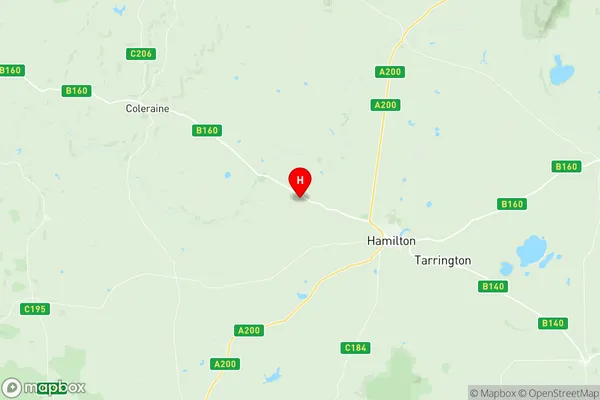
Southern Grampians Region Map
Southern Grampians Postcodes / Zip Codes
Southern Grampians Suburbs
Southern Grampians full address
Southern Grampians, Glenelg Southern Grampians, Warrnambool and South West, Victoria, VIC, Australia, SaCode: 217011423Country
Southern Grampians, Glenelg Southern Grampians, Warrnambool and South West, Victoria, VIC, Australia, SaCode: 217011423
Southern Grampians Suburbs & Region, Southern Grampians Map & Postcodes has 0 areas or regions above, and there are 57 Southern Grampians suburbs below. The sa2code for the Southern Grampians region is 217011423. Its latitude and longitude coordinates are -37.6993,141.899. Southern Grampians area belongs to Australia's greater capital city Rest of Vic..
Southern Grampians Suburbs & Localities
1. Buckley Swamp
2. Warrayure
3. Branxholme
4. Coleraine
5. Culla
6. Melville Forest
7. Muntham
8. Nareen
9. Tarrenlea
10. Gazette
11. Penshurst
12. Tabor
13. Dunkeld
14. Karabeal
15. Victoria Point
16. Victoria Valley
17. Woodhouse
18. Croxton East
19. Grampians
20. Woohlpooer
21. Hilgay
22. Konongwootong
23. Cherrypool
24. Englefield
25. Gatum
26. Mirranatwa
27. Moutajup
28. Morgiana
29. Strathkellar
30. Tarrington
31. Yulecart
32. Glenisla
33. Mooralla
34. Coojar
35. Gringegalgona
36. Gritjurk
37. Tarrayoukyan
38. Wootong Vale
39. Glenthompson
40. Byaduk North
41. Bochara
42. Byaduk
43. Hensley Park
44. Mount Napier
45. Wannon
46. Yatchaw
47. Carapook
48. Muntham
49. Bulart
50. Cavendish
51. Brit Brit
52. Clover Flat
53. Parkwood
54. Rocklands
55. Vasey
56. Balmoral
57. Pigeon Ponds