Glenelg (Vic.) Suburbs & Region, Glenelg (Vic.) Map & Postcodes
Glenelg (Vic.) Suburbs & Region, Glenelg (Vic.) Map & Postcodes in Glenelg (Vic.), Glenelg Southern Grampians, Warrnambool and South West, VIC, AU
Glenelg (Vic.) Region
Region Name
Glenelg (Vic.) (VIC, AU)Glenelg (Vic.) Area
6121 square kilometers (6,121 ㎢)Postal Codes
3285, 3286, 3292, from 3301 to 3305, from 3309 to 3312, and 3315 (In total, there are 13 postcodes in Glenelg (Vic.).)Glenelg (Vic.) Suburb Area Map (Polygon)

Australia State
City or Big Region
Greater Capital City
Rest of Vic. (2RVIC)District or Regional Area
Suburb Name
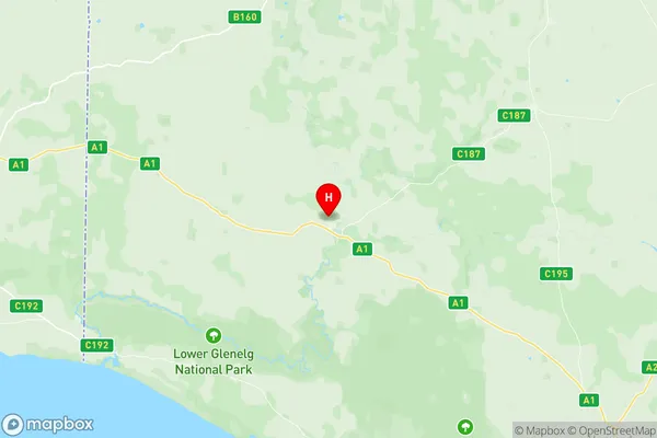
Glenelg (Vic.) Region Map
Glenelg (Vic.) Postcodes / Zip Codes
Glenelg (Vic.) Suburbs
Glenelg (Vic.) full address
Glenelg (Vic.), Glenelg Southern Grampians, Warrnambool and South West, Victoria, VIC, Australia, SaCode: 217011420Country
Glenelg (Vic.), Glenelg Southern Grampians, Warrnambool and South West, Victoria, VIC, Australia, SaCode: 217011420
Glenelg (Vic.) Suburbs & Region, Glenelg (Vic.) Map & Postcodes has 0 areas or regions above, and there are 54 Glenelg (Vic.) suburbs below. The sa2code for the Glenelg (Vic.) region is 217011420. Its latitude and longitude coordinates are -37.9144,141.273. Glenelg (Vic.) area belongs to Australia's greater capital city Rest of Vic..
Glenelg (Vic.) Suburbs & Localities
1. Tyrendarra
2. Condah Swamp
3. Narrawong
4. Breakaway Creek
5. Condah
6. Hotspur
7. Drumborg
8. Myamyn
9. Gorae
10. Heathmere
11. Puralka
12. Henty
13. Lindsay
14. Wando Bridge
15. Tahara Bridge
16. Nelson
17. Wallacedale
18. Allestree
19. Cape Bridgewater
20. Gorae West
21. Mount Richmond
22. Digby
23. Sandford
24. Strathdownie
25. Wando Vale
26. Lake Condah
27. Dartmoor
28. Drik Drik
29. Greenwald
30. Heywood
31. Bolwarra
32. Cashmore
33. Dutton Way
34. Casterton
35. Bahgallah
36. Brimboal
37. Dunrobin
38. Warrock
39. Tahara
40. Grassdale
41. Condah Swamp
42. Homerton
43. Lyons
44. Milltown
45. Mumbannar
46. Winnap
47. Merino
48. Tahara West
49. Corndale
50. Heath Field
51. Killara
52. Lake Mundi
53. Nangeela
54. Paschendale