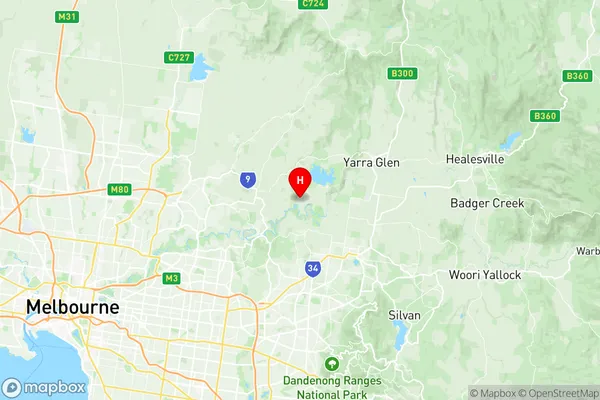
Panton Hill St Andrews Suburbs & Region, Panton Hill St Andrews Map & Postcodes
Panton Hill St Andrews Suburbs & Region, Panton Hill St Andrews Map & Postcodes in Panton Hill St Andrews, Yarra Ranges, Melbourne Outer East, VIC, AU
Panton Hill St Andrews Region
Region Name
Panton Hill St Andrews (VIC, AU)Panton Hill St Andrews Area
292.2 square kilometers (292.2 ㎢)Postal Codes
3097, 3099, 3754, from 3759 to 3761, and 3775 (In total, there are 7 postcodes in Panton Hill St Andrews.)Panton Hill St Andrews Introduction
Panton Hill is a suburb in Melbourne, Victoria, Australia, 8 km east of Melbourne's central business district (CBD). Its local government area is the City of Banyule. At the 2016 Census, Panton Hill had a population of 4,653. Panton Hill was named after the Panton Hill Hotel, which was built on the site in 1861. The hotel was a popular meeting place for local residents and was known for its fine food and wine. The suburb was developed in the late 19th and early 20th centuries as a residential area for workers in the nearby manufacturing industries. The suburb has a variety of housing styles, including Victorian and Edwardian terrace houses, bungalows, and apartments. There are also several parks and recreational facilities, including the Panton Hill Reserve, which has a playground, walking tracks, and a cricket ground. Panton Hill is well-serviced by public transport, with several bus routes and the EastLink freeway passing through the suburb. The suburb is also home to several schools, including Panton Hill Primary School and St John of God College. In conclusion, Panton Hill is a vibrant and diverse suburb with a rich history and a strong sense of community. Its convenient location, well-serviced infrastructure, and variety of housing options make it an attractive place to live for people of all ages and backgrounds.Australia State
City or Big Region
Greater Capital City
Greater Melbourne (2GMEL)District or Regional Area
Suburb Name
Panton Hill St Andrews Region Map

Panton Hill St Andrews Postcodes / Zip Codes
Panton Hill St Andrews Suburbs
Panton Hill St Andrews full address
Panton Hill St Andrews, Yarra Ranges, Melbourne Outer East, Victoria, VIC, Australia, SaCode: 209031212Country
Panton Hill St Andrews, Yarra Ranges, Melbourne Outer East, Victoria, VIC, Australia, SaCode: 209031212
Panton Hill St Andrews Suburbs & Region, Panton Hill St Andrews Map & Postcodes has 0 areas or regions above, and there are 12 Panton Hill St Andrews suburbs below. The sa2code for the Panton Hill St Andrews region is 209031212. Its latitude and longitude coordinates are -37.6981,145.276. Panton Hill St Andrews area belongs to Australia's greater capital city Greater Melbourne.
Panton Hill St Andrews Suburbs & Localities
1. Cottles Bridge
2. Strathewen
3. Arthurs Creek
4. Nutfield
5. Bend Of Islands
6. Watsons Creek
7. St Andrews
8. Doreen
9. Christmas Hills
10. Panton Hill
11. Smiths Gully
12. Smiths Gully
