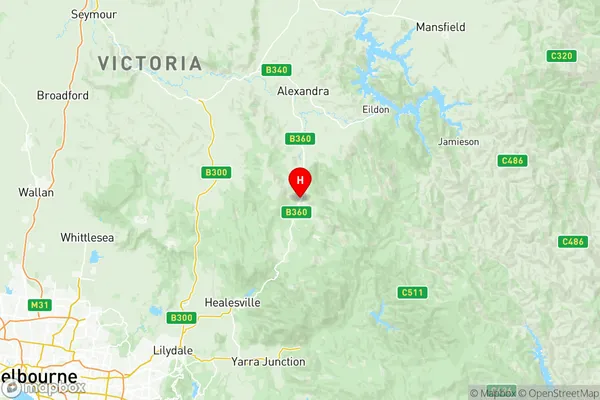
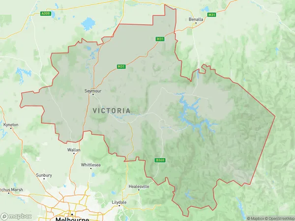
Upper Goulburn Valley Suburbs & Region, Upper Goulburn Valley Map & Postcodes
Upper Goulburn Valley Suburbs & Region, Upper Goulburn Valley Map & Postcodes in Upper Goulburn Valley, Hume, VIC, AU
Upper Goulburn Valley Region
Region Name
Upper Goulburn Valley (VIC, AU)Upper Goulburn Valley Area
13959 square kilometers (13,959 ㎢)Postal Codes
3444, 3521, 3522, 3607, from 3659 to 3665, from 3711 to 3715, from 3717 to 3719, 3722, 3724, and 3779 (In total, there are 22 postcodes in Upper Goulburn Valley.)Upper Goulburn Valley Introduction
Upper Goulburn Valley is a locality in the local government area of the Shire of Buloke, Victoria, Australia. It is located 142 km north-east of Melbourne, and 16 km north-west of Seymour. The post office opened as Mount Tarcoola on 1 November 1892 and was closed on 1 October 1972. The Upper Goulburn Valley Reservoir is located in the area.Australia State
City or Big Region
District or Regional Area
Upper Goulburn Valley Region Map

Upper Goulburn Valley Postcodes / Zip Codes
Upper Goulburn Valley Suburbs
Upper Goulburn Valley full address
Upper Goulburn Valley, Hume, Victoria, VIC, Australia, SaCode: 20401Country
Upper Goulburn Valley, Hume, Victoria, VIC, Australia, SaCode: 20401
Upper Goulburn Valley Suburbs & Region, Upper Goulburn Valley Map & Postcodes has 3 areas or regions above, and there are 88 Upper Goulburn Valley suburbs below. The sa3code for the Upper Goulburn Valley region is 20401. Its latitude and longitude coordinates are -37.4304,145.702.
Upper Goulburn Valley Suburbs & Localities
1. Edgecombe
2. Kyneton South
3. Lyal
4. Metcalfe East
5. Pastoria East
6. Pipers Creek
7. Redesdale
8. Sidonia
9. Spring Hill
10. Tylden South
11. Barfold
12. Baynton
13. Greenhill
14. Lauriston
15. Myrtle Creek
16. Pastoria
17. Tylden
18. Baynton East
19. Glenhope
20. Kyneton
21. Langley
22. Mia Mia
23. Emu Flat
24. Tooborac
25. Kerrisdale
26. Seymour South
27. Locksley
28. Longwood
29. Pranjip
30. Tallarook
31. Dropmore
32. Kobyboyn
33. Seymour
34. Whiteheads Creek
35. Seymour
36. Mangalore
37. Eildon
38. Acheron
39. Cathkin
40. Devils River
41. Taggerty
42. Homewood
43. Limestone
44. Yea
45. Kanumbra
46. Mansfield
47. Mansfield
48. Marysville
49. Alexandra
50. Crystal Creek
51. Maintongoon
52. Merton
53. Woodfield
54. Terip Terip
55. Pyalong
56. Glenhope East
57. Tabilk
58. Sugarloaf Creek
59. Northwood
60. Avenel
61. Upton Hill
62. Lake Eildon
63. Koriella
64. Whanregarwen
65. Ancona
66. Ghin Ghin
67. Glenburn
68. Molesworth
69. Barwite
70. Mirimbah
71. Caveat
72. Dysart
73. Highlands
74. Hilldene
75. Trawool
76. Puckapunyal
77. Puckapunyal Milpo
78. Buxton
79. Rubicon
80. Thornton
81. Taylor Bay
82. Fawcett
83. Flowerdale
84. Killingworth
85. Murrindindi
86. Gobur
87. Yarck
88. Cambarville
