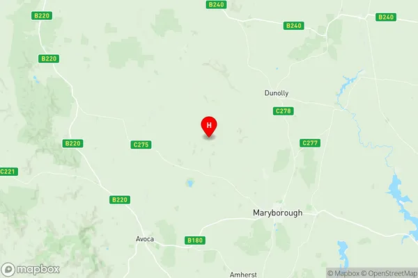
Maryborough Region Suburbs & Region, Maryborough Region Map & Postcodes
Maryborough Region Suburbs & Region, Maryborough Region Map & Postcodes in Maryborough Region, Campaspe, Shepparton, VIC, AU
Maryborough Region Region
Region Name
Maryborough Region (VIC, AU)Maryborough Region Area
1628 square kilometers (1,628 ㎢)Postal Codes
3370, 3371, 3464, 3465, 3472, 3475, and 3551 (In total, there are 7 postcodes in Maryborough Region.)Maryborough Region Introduction
Shepparton is a city in north-central Victoria, Australia. It is located on the Murray River, at the junction of the Goulburn and Broken rivers, and is 145 km north-east of Melbourne. The city had a population of 30,629 at the 2016 census. Shepparton is known for its agriculture, with a large number of farms producing cotton, wheat, and other crops. The city is also home to a number of manufacturing and processing industries, including food processing, textiles, and machinery manufacturing. The city has a number of cultural and recreational facilities, including the Shepparton Art Museum, the Shepparton Regional Gallery, and the Shepparton Performing Arts Centre. The city is also home to a number of parks and gardens, including the Riverside Reserve and the Shepparton Botanic Gardens. Shepparton is located in the Maryborough Region, which is a major agricultural region in Victoria. The region is known for its rich soils and temperate climate, which are ideal for growing a wide range of crops. The region is also home to a number of wineries and breweries, which produce a variety of alcoholic beverages. The Maryborough Region is also home to a number of historic towns and villages, including Tatura, Numurkah, and Echuca. These towns have a rich history and a number of historic buildings and landmarks, including the TaturAustralia State
City or Big Region
Greater Capital City
Rest of Vic. (2RVIC)District or Regional Area
Suburb Name
Maryborough Region Region Map

Maryborough Region Postcodes / Zip Codes
Maryborough Region Suburbs
Maryborough Region full address
Maryborough Region, Campaspe, Shepparton, Victoria, VIC, Australia, SaCode: 201031017Country
Maryborough Region, Campaspe, Shepparton, Victoria, VIC, Australia, SaCode: 201031017
Maryborough Region Suburbs & Region, Maryborough Region Map & Postcodes has 0 areas or regions above, and there are 41 Maryborough Region suburbs below. The sa2code for the Maryborough Region region is 201031017. Its latitude and longitude coordinates are -36.9317,143.601. Maryborough Region area belongs to Australia's greater capital city Rest of Vic..
Maryborough Region Suburbs & Localities
1. Amherst
2. Mount Glasgow
3. Talbot
4. Mount Cameron
5. Lillicur
6. Alma
7. Wareek
8. Goldsborough
9. Carisbrook
10. Adelaide Lead
11. Bowenvale
12. Cotswold
13. Craigie
14. Golden Point
15. Majorca
16. Moolort
17. Moonlight Flat
18. Rodborough
19. Simson
20. Timor
21. Dunluce
22. Moliagul
23. Mount Hooghly
24. Caralulup
25. Red Lion
26. Stony Creek
27. Daisy Hill
28. Flagstaff
29. Havelock
30. Timor West
31. Eddington
32. Archdale
33. Bung Bong
34. Bet Bet
35. Betley
36. Bromley
37. Dunolly
38. Inkerman
39. Archdale Junction
40. Bealiba
41. Painswick
