Beaufort Suburbs & Region, Beaufort Map & Postcodes
Beaufort Suburbs & Region, Beaufort Map & Postcodes in Beaufort, Maryborough Pyrenees, Ballarat, VIC, AU
Beaufort Region
Region Name
Beaufort (VIC, AU)Beaufort Area
1863 square kilometers (1,863 ㎢)Postal Codes
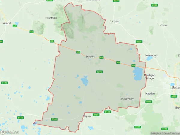
3351, 3352, 3361, 3373, 3375, 3377, 3468, and 3469 (In total, there are 8 postcodes in Beaufort.)Beaufort Suburb Area Map (Polygon)
Beaufort Introduction
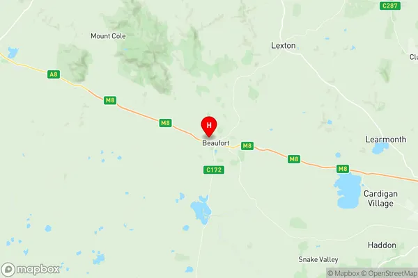
Beaufort is a suburb of Ballarat, Victoria, Australia. It is located 4 km north-west of Ballarat's central business district. The post office opened as Beaufort on 1 October 1851 and was closed on 1 March 1976. The name "Beaufort" is derived from the French word "beau," meaning beautiful, and "fort," meaning strong or fortified. The suburb was named after the Duke of Beaufort, who was a British general. The 1851 census reported that Beaufort had a population of 1,034.Australia State
City or Big Region
Greater Capital City
Rest of Vic. (2RVIC)District or Regional Area
Suburb Name
Beaufort Region Map
Beaufort Postcodes / Zip Codes
Beaufort Suburbs
Beaufort full address
Beaufort, Maryborough Pyrenees, Ballarat, Victoria, VIC, Australia, SaCode: 201031014Country
Beaufort, Maryborough Pyrenees, Ballarat, Victoria, VIC, Australia, SaCode: 201031014
Beaufort Suburbs & Region, Beaufort Map & Postcodes has 0 areas or regions above, and there are 29 Beaufort suburbs below. The sa2code for the Beaufort region is 201031014. Its latitude and longitude coordinates are -37.4229,143.37. Beaufort area belongs to Australia's greater capital city Rest of Vic..
Beaufort Suburbs & Localities
1. Bo Peep
2. Carngham
3. Mount Emu
4. Brewster
5. Beaufort
6. Chute
7. Cross Roads
8. Nerring
9. Stoneleigh
10. Trawalla
11. Mortchup
12. Burrumbeet
13. Carranballac
14. Mena Park
15. Shirley
16. Middle Creek
17. Mount Lonarch
18. Mount Lonarch
19. Hillcrest
20. Ercildoune
21. Chepstowe
22. Langi Kal Kal
23. Lake Goldsmith
24. Snake Valley
25. Main Lead
26. Raglan
27. Stockyard Hill
28. Waterloo
29. Glenlogie