Lawson Hazelbrook Linden Suburbs & Region, Lawson Hazelbrook Linden Map & Postcodes
Lawson Hazelbrook Linden Suburbs & Region, Lawson Hazelbrook Linden Map & Postcodes in Lawson Hazelbrook Linden, Blue Mountains, Sydney Outer West and Blue Mountains, NSW, AU
Lawson Hazelbrook Linden Region
Region Name
Lawson Hazelbrook Linden (NSW, AU)Lawson Hazelbrook Linden Area
46.89 square kilometers (46.89 ㎢)Postal Codes
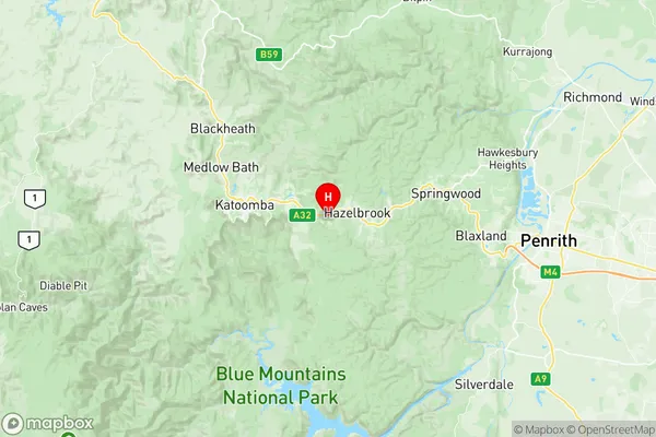
2778, 2779, 2783, and 2784 (In total, there are 4 postcodes in Lawson Hazelbrook Linden.)Lawson Hazelbrook Linden Suburb Area Map (Polygon)

Lawson Hazelbrook Linden Introduction
Lawson Hazelbrook Linden is a suburb located in the local government area of the City of Blue Mountains, New South Wales, Australia. It is situated 66 kilometers west of Sydney's central business district and is part of the Greater Western Sydney region. The suburb is named after Lawson Hazelbrook, who was a prominent local landowner and businessman. The suburb has a population of around 11,000 people and is known for its natural beauty, including the Blue Mountains National Park. It is home to a variety of recreational facilities, including parks, playgrounds, and sports fields, and is surrounded by picturesque bushland. Lawson Hazelbrook Linden is also well-connected to other parts of the city, with easy access to the M4 motorway and public transportation. The suburb has a mix of residential and commercial properties, with a variety of shops, cafes, and restaurants located along the main street. There is also a small hospital and a community center, which provide services to the local community. In terms of education, Lawson Hazelbrook Linden is home to a number of primary and secondary schools, including a public high school and a private college. The suburb is also well-known for its agricultural industry, with a number of farms and orchards located in the surrounding area. Overall, Lawson Hazelbrook Linden is a vibrant and welcoming suburb that offers a high quality of life to its residents. Its natural beauty, recreational facilities, and convenient location makeAustralia State
City or Big Region
Greater Capital City
Greater Sydney (1GSYD)District or Regional Area
Suburb Name
Lawson Hazelbrook Linden Region Map
Lawson Hazelbrook Linden Postcodes / Zip Codes
Lawson Hazelbrook Linden Suburbs
Lawson Hazelbrook Linden full address
Lawson Hazelbrook Linden, Blue Mountains, Sydney Outer West and Blue Mountains, New South Wales, NSW, Australia, SaCode: 124011453Country
Lawson Hazelbrook Linden, Blue Mountains, Sydney Outer West and Blue Mountains, New South Wales, NSW, Australia, SaCode: 124011453
Lawson Hazelbrook Linden Suburbs & Region, Lawson Hazelbrook Linden Map & Postcodes has 0 areas or regions above, and there are 5 Lawson Hazelbrook Linden suburbs below. The sa2code for the Lawson Hazelbrook Linden region is 124011453. Its latitude and longitude coordinates are -33.728,150.417. Lawson Hazelbrook Linden area belongs to Australia's greater capital city Greater Sydney.
Lawson Hazelbrook Linden Suburbs & Localities
1. Hazelbrook
2. Lawson
3. Woodford
4. Bullaburra
5. Linden