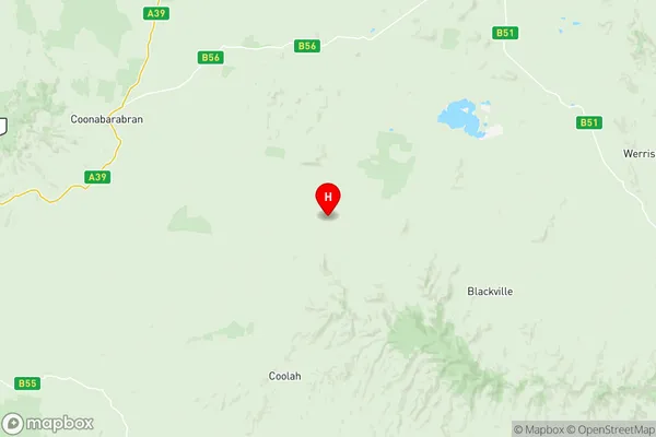
Dubbo Suburbs & Region, Dubbo Map & Postcodes
Dubbo Suburbs & Region, Dubbo Map & Postcodes in Dubbo, Far West and Orana, NSW, AU
Dubbo Region
Region Name
Dubbo (NSW, AU)Dubbo Area
29738 square kilometers (29,738 ㎢)Postal Codes
2357, 2395, 2396, 2817, 2818, from 2820 to 2823, from 2826 to 2831, 2838, 2842, 2843, 2852, and from 2866 to 2869 (In total, there are 23 postcodes in Dubbo.)Dubbo Introduction
Dubbo is a city in the Central West region of New South Wales, Australia. It is the administrative center of the Dubbo Regional Council and is located on the Macquarie River. The city has a population of around 20,000 people and is known for its agriculture, particularly wool production. Dubbo is also home to a number of cultural institutions, including the Dubbo Regional Museum and the Dubbo City Library. The city is surrounded by the Dubbo Regional Council area, which covers a vast area of central western New South Wales, including the towns of Coonamble, Narromine, and Warren.Australia State
City or Big Region
District or Regional Area
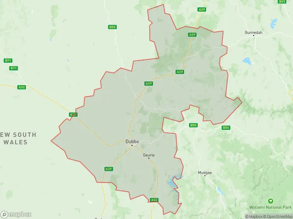
Dubbo Region Map

Dubbo Postcodes / Zip Codes
Dubbo Suburbs
Mudgee Region West
Dubbo full address
Dubbo, Far West and Orana, New South Wales, NSW, Australia, SaCode: 10503Country
Dubbo, Far West and Orana, New South Wales, NSW, Australia, SaCode: 10503
Dubbo Suburbs & Region, Dubbo Map & Postcodes has 9 areas or regions above, and there are 191 Dubbo suburbs below. The sa3code for the Dubbo region is 10503. Its latitude and longitude coordinates are -31.4859,149.829.
Dubbo Suburbs & Localities
1. Bomera
2. Bugaldie
3. Dandry
4. Purlewaugh
5. Rocky Glen
6. Wattle Springs
7. Yearinan
8. Binnaway
9. Goorianawa
10. Kenebri
11. Gowang
12. Coonabarabran
13. Tannabar
14. Baradine
15. Ropers Road
16. Weetaliba
17. Barwon
18. Box Ridge
19. Ulamambri
20. Tooraweenah
21. Benolong
22. Apsley
23. Arthurville
24. Bodangora
25. Dripstone
26. Gollan
27. Maryvale
28. Nanima
29. Spicers Creek
30. Suntop
31. Wellington
32. Wuuluman
33. Burroway
34. Narromine
35. Cathundral
36. Bakers Swamp
37. Curra Creek
38. Montefiores
39. Stuart Town
40. Yarragal
41. Bundemar
42. Trangie
43. Breelong
44. Collie
45. Conimbia
46. Teridgerie
47. Barbigal
48. Muronbung
49. Talbragar
50. Terramungamine
51. Armatree
52. Balladoran
53. Brenda
54. Coolabah
55. Elong Elong
56. Macquarie Marshes
57. Merrygoen
58. Quambone
59. Mollyan
60. Nevertire
61. Gilgandra
62. Merrigal
63. Black Hollow
64. Gulargambone
65. Warrumbungle
66. Billeroy
67. Combara
68. Magometon
69. Tooloon
70. Wingadee
71. Ballimore
72. Beni
73. Eulomogo
74. Manera Heights
75. Minore
76. Rawsonville
77. Troy Junction
78. Whylandra Crossing
79. Carinda
80. Girilambone
81. Goodooga
82. Neilrex
83. Nevertire
84. Tonderburine
85. Terrabella
86. Comobella
87. Farnham
88. Lake Burrendong
89. Medway
90. Mount Aquila
91. Walmer
92. Balladoran
93. Gin Gin
94. Bearbong
95. Biddon
96. Bourbah
97. Quanda
98. Tonderburine
99. Gilgooma
100. Gungalman
101. Geurie
102. Ponto
103. Mookerawa
104. Mount Arthur
105. Mumbil
106. Neurea
107. North Yeoval
108. Wyanga
109. Eumungerie
110. Dandaloo
111. Curban
112. Armatree
113. Mount Tenandra
114. Coonamble
115. Brocklehurst
116. Delroy Gardens
117. Dickygundi
118. Dubbo East
119. Dubbo Grove
120. Dubbo West
121. Nebea
122. Pine Grove
123. Urawilkie
124. Boothenba
125. Cumboogle
126. Dubbo
127. Dubbo Dc
128. Eschol
129. Mogriguy
130. Toongi
131. Hermidale
132. Nymagee
133. Pine Clump
134. The Marra
135. Tooraweenah
136. Wongarbon
137. Mendooran
138. New Mollyan
139. Yarragrin
140. Coolah
141. Barneys Reef
142. Goonoo Forest
143. Kickabil
144. Orana Heights
145. Wambangalang
146. Bullagreen
147. Byrock
148. Eumungerie
149. Geurie
150. Muriel
151. Nubingerie
152. Ponto
153. Terrabella
154. Westella
155. Goodooga
156. Beryl
157. Cumbandry
158. Goolma
159. Gulgong
160. Guntawang
161. Merotherie
162. Euchareena
163. Larras Lee
164. The Shades
165. Yullundry
166. Obley
167. Yeoval
168. Bungaba
169. Mebul
170. Tallawang
171. Cundumbul
172. Garra
173. Cumnock
174. Eurimbla
175. Eurimbula
176. North Yeoval
177. Mungery
178. Tomingley
179. Trewilga
180. Biraganbil
181. Cope
182. Two Mile Flat
183. Amaroo
184. Boomey
185. Warnecliffe
186. Peak Hill
187. Stubbo
188. Molong
189. Baldry
190. Loombah
191. Bournewood
