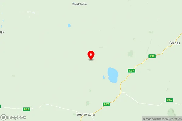
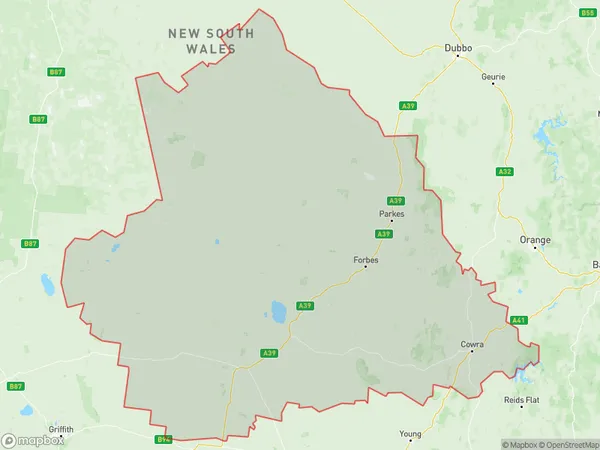
Lachlan Valley Suburbs & Region, Lachlan Valley Map & Postcodes
Lachlan Valley Suburbs & Region, Lachlan Valley Map & Postcodes in Lachlan Valley, Central West, NSW, AU
Lachlan Valley Region
Region Name
Lachlan Valley (NSW, AU)Lachlan Valley Area
41001 square kilometers (41,001 ㎢)Postal Codes
2671, 2721, 2794, from 2804 to 2810, 2871, and from 2873 to 2876 (In total, there are 15 postcodes in Lachlan Valley.)Lachlan Valley Introduction
Lachlan Valley is a rural locality in the Central West region of New South Wales, Australia. It is located in the local government area of the Cabonne Shire and is situated between the towns of Cowra and Forbes. The valley is known for its agricultural productivity, particularly in the production of wheat and cotton. The Lachlan River flows through the valley, providing water for irrigation and hydroelectric power generation. The area has a rich history, with evidence of early European settlement dating back to the 1820s. There are several historic sites in the valley, including the Lachlan Valley Railway and the Lachlan River Power Station. The population of the valley is approximately 1,500 people, and the town of Forbes is the major population center in the region.Australia State
City or Big Region
District or Regional Area
Lachlan Valley Region Map

Lachlan Valley Postcodes / Zip Codes
Lachlan Valley Suburbs
Lachlan Valley full address
Lachlan Valley, Central West, New South Wales, NSW, Australia, SaCode: 10302Country
Lachlan Valley, Central West, New South Wales, NSW, Australia, SaCode: 10302
Lachlan Valley Suburbs & Region, Lachlan Valley Map & Postcodes has 7 areas or regions above, and there are 75 Lachlan Valley suburbs below. The sa3code for the Lachlan Valley region is 10302. Its latitude and longitude coordinates are -33.5163,147.253.
Lachlan Valley Suburbs & Localities
1. West Wyalong
2. Lake Cowal
3. Alleena
4. Back Creek
5. North Yalgogrin
6. Wyalong
7. Burcher
8. Bland
9. Hovells Creek
10. Westville
11. Bumbaldry
12. Mount Collins
13. Wattamondara
14. Pinnacle
15. Pullabooka
16. Canowindra
17. Gooloogong
18. Greenethorpe
19. Bimbi
20. Quandialla
21. Cowra
22. Noonbinna
23. Billimari
24. Eugowra
25. Nanami
26. Caragabal
27. Glenelg
28. Warraderry
29. Burdett
30. Moorbel
31. Nyrang Creek
32. Trajere
33. Koorawatha
34. Wyangala
35. Grenfell
36. Piney Range
37. Bandon
38. Grawlin
39. Ooma
40. Yarragong
41. Fifield
42. Ootha
43. The Troffs
44. Yarrabandai
45. Nelungaloo
46. Bedgerebong
47. Carrawabbity
48. Corinella
49. Cumbijowa
50. Fairholme
51. Gunning Gap
52. Warroo
53. Five Ways
54. Lansdale
55. Tottenham
56. Bruie Plains
57. Bogan Gate
58. Botfields
59. Gunningbland
60. Bedgerabong
61. Forbes
62. Mulyandry
63. Paytens Bridge
64. Wirrinya
65. Albert
66. Tullamore
67. Yethera
68. Trundle
69. Bundaburrah
70. Calarie
71. Garema
72. Jemalong
73. Weelong
74. Miamley
75. Gunning Gap
