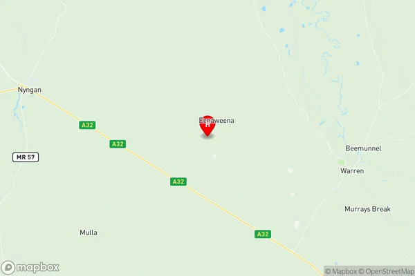
Nyngan Warren Suburbs & Region, Nyngan Warren Map & Postcodes
Nyngan Warren Suburbs & Region, Nyngan Warren Map & Postcodes in Nyngan Warren, Lachlan Valley, Central West, NSW, AU
Nyngan Warren Region
Region Name
Nyngan Warren (NSW, AU)Nyngan Warren Area
21216 square kilometers (21,216 ㎢)Postal Codes
2058, 2348, from 2824 to 2826, 2831, 2873, 2877, and 2890 (In total, there are 9 postcodes in Nyngan Warren.)Nyngan Warren Introduction
Nyngan Warren is a locality in the Central West region of New South Wales, Australia. It is located in the Warren Shire and is situated by the Macquarie River. The town is a major agricultural hub, with a large number of farms producing cotton, wheat, and sheep. The town has a population of around 2,000 people and is known for its historic railway station and the Nyngan Showground. The Showground hosts a variety of events, including the Nyngan Show, which is one of the largest agricultural shows in New South Wales.Australia State
City or Big Region
Greater Capital City
Rest of NSW (1RNSW)District or Regional Area
Suburb Name
Nyngan Warren Region Map

Nyngan Warren Postcodes / Zip Codes
Nyngan Warren Suburbs
Nyngan Warren full address
Nyngan Warren, Lachlan Valley, Central West, New South Wales, NSW, Australia, SaCode: 105011095Country
Nyngan Warren, Lachlan Valley, Central West, New South Wales, NSW, Australia, SaCode: 105011095
Nyngan Warren Suburbs & Region, Nyngan Warren Map & Postcodes has 0 areas or regions above, and there are 37 Nyngan Warren suburbs below. The sa2code for the Nyngan Warren region is 105011095. Its latitude and longitude coordinates are -31.6448,147.55. Nyngan Warren area belongs to Australia's greater capital city Rest of NSW.
Nyngan Warren Suburbs & Localities
1. Northern Suburbs Mc
2. New England Mc
3. Eenaweena
4. Mount Harris
5. Oxley
6. Snakes Plain
7. Bogan
8. Canonba
9. Brenda
10. Coolabah
11. Beemunnel
12. Mumblebone Plain
13. Red Hill
14. Buddabadah
15. Miandetta
16. Mullengudgery
17. Nyngan
18. Pangee
19. Warrigal
20. Bogan
21. Nevertire
22. Girilambone
23. Nevertire
24. Mount Foster
25. Ravenswood
26. Warren
27. Babinda
28. Honeybugle
29. Murrawombie
30. Mulla
31. Hermidale
32. The Marra
33. Muriel
34. Australian Defence Forces
35. Five Ways
36. Bobadah
37. Forces
