Central West Suburbs & Region, Central West Map & Postcodes
Central West Suburbs & Region, Central West Map & Postcodes in Central West, NSW, AU
Central West Region
Region Name
Central West (NSW, AU)Central West Area
70297 square kilometers (70,297 ㎢)Postal Codes
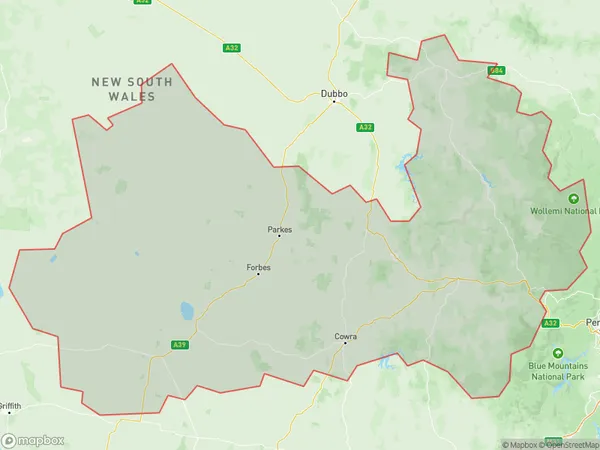
2583, 2671, 2721, from 2791 to 2795, from 2797 to 2800, from 2804 to 2810, from 2844 to 2849, 2864, 2865, 2870, 2871, and from 2873 to 2876 (In total, there are 33 postcodes in Central West.)Central West Suburb Area Map (Polygon)
Central West Introduction
Central West, Central West, New South Wales, AU, is a locality in the Central West region of New South Wales, Australia. It is located in the Macquarie Valley and is home to the towns of Cowra, Forbes, and Orange. The area is known for its agriculture, particularly cotton farming, and for its rich history, including the construction of the Great Western Highway. The population of the locality was 11,496 at the 2011 census.Australia State
City or Big Region
Central West Region Map
Central West Postcodes / Zip Codes
Central West Suburbs
Lachlan Valley
Lithgow Mudgee
Central West full address
Central West, New South Wales, NSW, Australia, SaCode: 103Country
Central West, New South Wales, NSW, Australia, SaCode: 103
Central West Suburbs & Region, Central West Map & Postcodes has 4 areas or regions above, and there are 353 Central West suburbs below. The sa4code for the Central West region is 103. Its latitude and longitude coordinates are -34.0808,149.221.
Central West Suburbs & Localities
1. Binda
2. Abercrombie River
3. Hovells Creek
4. Wyangala
5. Vittoria
6. Burcher
7. Fifield
8. Fairholme
9. Lansdale
10. Tullamore
11. Mount Mcdonald
12. Cranbury
13. Canowindra
14. Gooloogong
15. Koorawatha
16. Eugowra
17. Murga
18. Daroobalgie
19. Gunning Gap
20. Pinnacle
21. Greenethorpe
22. Bland
23. Wallerawang
24. Round Swamp
25. Pipers Flat
26. Dunville Loop
27. Charbon
28. Birriwa
29. Carcoar
30. Flyers Creek
31. Garland
32. Burnt Yards
33. Gumble