ZipCode 2849 Areas, AU PostCode 2849 Suburbs
Postcode 2849 Suburbs, ZipCode 2849 Areas & Regions in Lithgow - Mudgee,NSW Australia
There are at least 29 AU suburbs share the same AU PostCode 2849 Suburbs in Lithgow - Mudgee.
Postal Code 2849 Regions
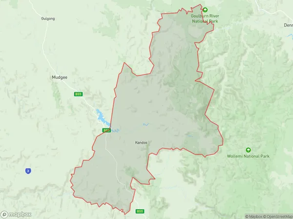
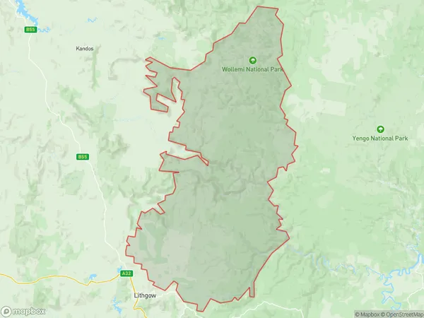
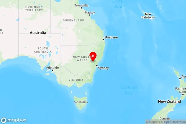
The Australia postcode 2849 regions include Lithgow Region, Mudgee Region - East, Wollangambe - Wollemi in the areas of Lithgow - Mudgee, Lithgow Region, These postcode areas are all located in the state New South Wales, NSW.
ZipCode 2849 Areas Map for Lithgow Region

AU PostCode 2849 Suburbs Map for Mudgee Region - East
Postal Code 2849 Regions Map for Wollangambe - Wollemi
AU PostCode 2849 Suburbs
AU PostCode 2849 suburbs contain Bogee, Breakfast Creek, Budden, Bylong, Camboon, Carwell, Coggan, Coxs Creek, Coxs Crown, Dabee, Dungeree, Dunville Loop, Ginghi, Glen Alice, Growee, Kelgoola, Lee Creek, Mount Marsden, Murrumbo, Nullo Mountain, Olinda, Pinnacle Swamp, Pyangle, Reedy Creek, Rylstone, Upper Bylong, Upper Growee, Upper Nile, Wirraba, you can check the below link to see the 29 suburbs detailed information.
AU PostCode 2849 Suburbs Map
ZipCode 2849 Areas
1. Bogee
2. Breakfast Creek
3. Budden
4. Bylong
5. Camboon
6. Carwell
7. Coggan
8. Coxs Creek
9. Coxs Crown
10. Dabee
11. Dungeree
12. Dunville Loop
13. Ginghi
14. Glen Alice
15. Growee
16. Kelgoola
17. Lee Creek
18. Mount Marsden
19. Murrumbo
20. Nullo Mountain
21. Olinda
22. Pinnacle Swamp
23. Pyangle
24. Reedy Creek
25. Rylstone
26. Upper Bylong
27. Upper Growee
28. Upper Nile
29. Wirraba