Huon Bruny Island Suburbs & Region, Huon Bruny Island Map & Postcodes
Huon Bruny Island Suburbs & Region, Huon Bruny Island Map & Postcodes in Huon Bruny Island, South East, TAS, AU
Huon Bruny Island Region
Region Name
Huon Bruny Island (TAS, AU)Huon Bruny Island Area
2193 square kilometers (2,193 ㎢)Postal Codes
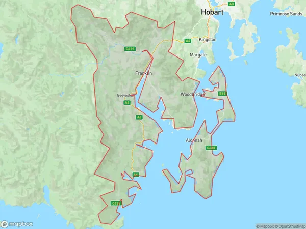
7054, 7109, 7112, 7113, 7116, 7117, 7150, 7155, 7162, and 7163 (In total, there are 10 postcodes in Huon Bruny Island.)Huon Bruny Island Suburb Area Map (Polygon)
Huon Bruny Island Introduction
Huon Pine trees dominate the landscape of Huon Bruny Island, a picturesque island in South East Tasmania. The island is renowned for its stunning natural beauty, including pristine beaches, dense forests, and rugged mountains. The Huon River, which flows through the island, provides a source of fresh water for the local community. Huon Bruny Island is home to a variety of wildlife, including the rare Huon pine, which is the tallest tree in Tasmania. The island also has a rich cultural heritage, with numerous historic sites and museums. Visitors can explore the island's many walking trails, including the famous Huon Trail, which follows the coastline for over 30 kilometers. The island is a popular destination for outdoor enthusiasts, with opportunities for hiking, kayaking, fishing, and wildlife watching.Australia State
City or Big Region
District or Regional Area
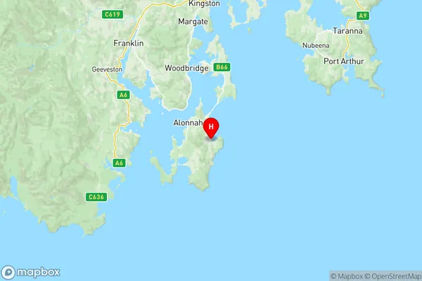
Huon Bruny Island Region Map
Huon Bruny Island Postcodes / Zip Codes
Huon Bruny Island Suburbs
Kingston Beach Blackmans Bay
Mount Wellington
South Hobart Fern Tree
Bruny Island Kettering
Geeveston Dover
Huonville Franklin
Huon Bruny Island full address
Huon Bruny Island, South East, Tasmania, TAS, Australia, SaCode: 60302Country
Huon Bruny Island, South East, Tasmania, TAS, Australia, SaCode: 60302
Huon Bruny Island Suburbs & Region, Huon Bruny Island Map & Postcodes has 8 areas or regions above, and there are 88 Huon Bruny Island suburbs below. The sa3code for the Huon Bruny Island region is 60302. Its latitude and longitude coordinates are -43.3667,147.333.
Huon Bruny Island Suburbs & Localities
1. Electrona
2. Neika
3. Nierinna
4. Glen Huon
5. Glendevie
6. Lucaston
7. Lune River
8. Lymington
9. Raminea
10. Wattle Grove
11. Cygnet
12. Gardners Bay
13. Randalls Bay
14. Franklin
15. Surges Bay
16. Alonnah
17. Apollo Bay
18. Dennes Point
19. Woodbridge
20. Flowerpot
21. Howden
22. Leslie Vale
23. Lower Snug
24. Piersons Point
25. Wellington Park
26. Catamaran
27. Cradoc
28. Ida Bay
29. Lonnavale
30. Lower Longley
31. Mountain River
32. Recherche
33. Southport
34. Strathblane
35. Waterloo
36. Abels Bay
37. Huon Island
38. Brooks Bay
39. Geeveston
40. Dover
41. Gordon
42. Kaoota
43. South Bruny
44. Upper Woodstock
45. Birchs Bay
46. Coningham
47. Margate
48. Glaziers Bay
49. Judbury
50. Petcheys Bay
51. Ranelagh
52. Garden Island Creek
53. Cairns Bay
54. Castle Forbes Bay
55. Surveyors Bay
56. Barnes Bay
57. Great Bay
58. Killora
59. Lunawanna
60. Simpsons Bay
61. Kettering
62. Barretta
63. Fern Tree
64. Ridgeway
65. Snug
66. Tinderbox
67. Crabtree
68. Grove
69. Hastings
70. Huonville
71. Lower Wattle Grove
72. Southport Lagoon
73. Woodstock
74. Charlotte Cove
75. Deep Bay
76. Eggs And Bacon Bay
77. Nicholls Rivulet
78. Verona Sands
79. Police Point
80. Port Huon
81. Adventure Bay
82. Allens Rivulet
83. Longley
84. North Bruny
85. Oyster Cove
86. Pelverata
87. Sandfly
88. Middleton