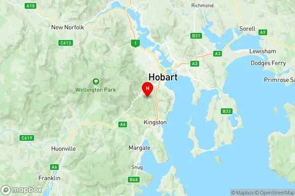
South Hobart Fern Tree Suburbs & Region, South Hobart Fern Tree Map & Postcodes
South Hobart Fern Tree Suburbs & Region, South Hobart Fern Tree Map & Postcodes in South Hobart Fern Tree, Huon Bruny Island, South East, TAS, AU
South Hobart Fern Tree Region
Region Name
South Hobart Fern Tree (TAS, AU)South Hobart Fern Tree Area
23.49 square kilometers (23.49 ㎢)Postal Codes
7004, and 7054 (In total, there are 2 postcodes in South Hobart Fern Tree.)South Hobart Fern Tree Introduction
The South Hobart Fern Tree is a tree located in South East Tasmania, Australia. It is estimated to be over 2,500 years old and is one of the oldest living ferns in the world. The tree is a species of Cyathea, a genus of ferns that are known for their long, fibrous roots and their ability to survive in harsh environments. The South Hobart Fern Tree is located in a private garden and is not accessible to the public. However, it is a popular tourist attraction and has been featured in many books and articles about the history and natural beauty of Tasmania.Australia State
City or Big Region
Greater Capital City
Greater Hobart (6GHOB)District or Regional Area
Suburb Name
South Hobart Fern Tree Region Map

South Hobart Fern Tree Postcodes / Zip Codes
South Hobart Fern Tree Suburbs
South Hobart Fern Tree full address
South Hobart Fern Tree, Huon Bruny Island, South East, Tasmania, TAS, Australia, SaCode: 601051032Country
South Hobart Fern Tree, Huon Bruny Island, South East, Tasmania, TAS, Australia, SaCode: 601051032
South Hobart Fern Tree Suburbs & Region, South Hobart Fern Tree Map & Postcodes has 0 areas or regions above, and there are 3 South Hobart Fern Tree suburbs below. The sa2code for the South Hobart Fern Tree region is 601051032. Its latitude and longitude coordinates are -42.9254,147.285. South Hobart Fern Tree area belongs to Australia's greater capital city Greater Hobart.
South Hobart Fern Tree Suburbs & Localities
1. South Hobart
2. Fern Tree
3. Ridgeway
