Robina Suburbs & Region, Robina Map & Postcodes
Robina Suburbs & Region, Robina Map & Postcodes in Robina, Gold Coast, QLD, AU
Robina Region
Region Name
Robina (QLD, AU)Robina Area
33.63 square kilometers (33.63 ㎢)Postal Codes
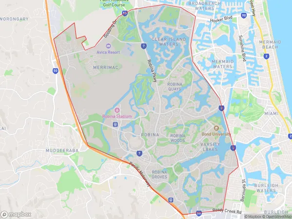
4211, 4220, 4226, 4227, 4229, and 4230 (In total, there are 6 postcodes in Robina.)Robina Suburb Area Map (Polygon)
Robina Introduction
Robina is a suburb in the City of Gold Coast, Queensland, Australia. It is located 12 kilometers south-west of the Gold Coast's central business district and is part of the Greater South East Queensland region. Robina is known for its shopping centers, including Robina Town Centre and Robina Fair. It is also home to the Robina Hospital and the Queensland University of Technology. The suburb has a population of over 50,000 people and is growing rapidly.Australia State
City or Big Region
District or Regional Area
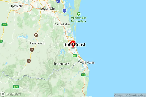
Robina Region Map
Robina Postcodes / Zip Codes
Robina Suburbs
Burleigh Heads
Burleigh Waters
Reedy Creek Andrews
Highland Park
Nerang Mount Nathan
Pacific Pines Gaven
Clear Island Waters
Varsity Lakes
Robina East
Robina West
Robina full address
Robina, Gold Coast, Queensland, QLD, Australia, SaCode: 30908Country
Robina, Gold Coast, Queensland, QLD, Australia, SaCode: 30908
Robina Suburbs & Region, Robina Map & Postcodes has 14 areas or regions above, and there are 35 Robina suburbs below. The sa3code for the Robina region is 30908. Its latitude and longitude coordinates are -28.042,153.398.
Robina Suburbs & Localities
1. Clagiraba
2. Highland Park
3. Lower Beechmont
4. Nerang Dc
5. Numinbah Valley
6. Pindari Hills
7. Binna Burra
8. Latimer
9. Pacific Pines
10. Burleigh Heads
11. Burleigh Town
12. Miami
13. Tally Valley
14. Clear Island Waters
15. Kerrydale
16. Robina Dc
17. Reedy Creek
18. Varsity Lakes
19. Burleigh Bc
20. Advancetown
21. Carrara
22. Mount Nathan
23. Natural Bridge
24. Nerang
25. Burleigh Dc
26. Beechmont
27. Gaven
28. Gilston
29. Nerang Bc
30. Southern Lamington
31. Merrimac
32. Robina
33. Burleigh Waters
34. Bond University
35. Robina Town Centre