Sandgate Suburbs & Region, Sandgate Map & Postcodes
Sandgate Suburbs & Region, Sandgate Map & Postcodes in Sandgate, Brisbane North, QLD, AU
Sandgate Region
Region Name
Sandgate (QLD, AU)Sandgate Area
31.75 square kilometers (31.75 ㎢)Postal Codes
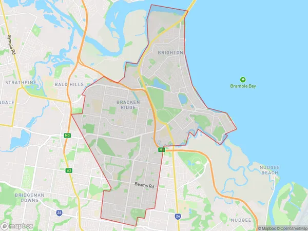
4017, 4018, 4034, and 4036 (In total, there are 4 postcodes in Sandgate.)Sandgate Suburb Area Map (Polygon)
Sandgate Introduction
Sandgate is a suburb in the City of Brisbane, Queensland, Australia. It is located 5 kilometers north of the Brisbane CBD and is bordered by the suburbs of Shorncliffe, Newport, and Redcliffe. Sandgate is known for its historic buildings, including the Sandgate Town Hall and the Sandgate Cemetery. It is also home to the Sandgate District Cricket Club and the Sandgate RSL Club. The suburb has a variety of shops, cafes, and restaurants, as well as a large shopping center and a cinema complex. Sandgate is well-connected to the rest of Brisbane via public transport, with several bus and train routes passing through the area.Australia State
City or Big Region
District or Regional Area
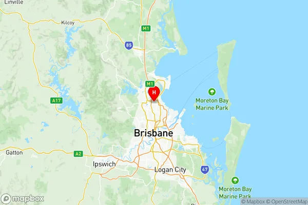
Sandgate Region Map
Sandgate Postcodes / Zip Codes
Sandgate Suburbs
Bracken Ridge
Brighton (Qld)
Sandgate Shorncliffe
Taigum Fitzgibbon
Sandgate full address
Sandgate, Brisbane North, Queensland, QLD, Australia, SaCode: 30204Country
Sandgate, Brisbane North, Queensland, QLD, Australia, SaCode: 30204
Sandgate Suburbs & Region, Sandgate Map & Postcodes has 11 areas or regions above, and there are 17 Sandgate suburbs below. The sa3code for the Sandgate region is 30204. Its latitude and longitude coordinates are -27.3237,153.027.
Sandgate Suburbs & Localities
1. Brighton
2. Brighton Eventide
3. Deagon
4. Boondall
5. Nashville
6. Bracken Ridge
7. Brighton Nathan Street
8. Fitzgibbon
9. Carseldine
10. Zillmere
11. Bald Hills
12. Sandgate
13. Sandgate Dc
14. Shorncliffe
15. Taigum
16. Aspley
17. Geebung