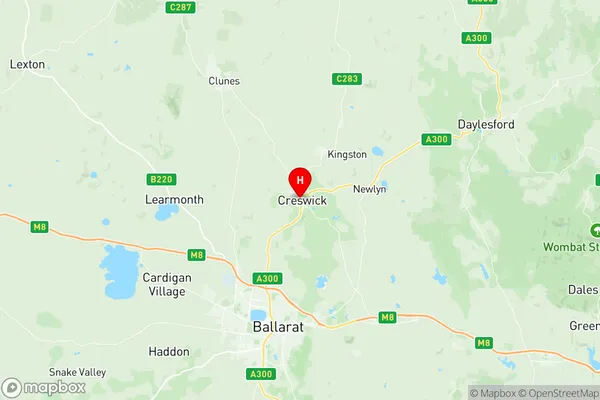
Creswick Clunes Suburbs & Region, Creswick Clunes Map & Postcodes
Creswick Clunes Suburbs & Region, Creswick Clunes Map & Postcodes in Creswick Clunes, Maryborough Pyrenees, Ballarat, VIC, AU
Creswick Clunes Region
Region Name
Creswick Clunes (VIC, AU)Creswick Clunes Area
856.79 square kilometers (856.79 ㎢)Postal Codes
3352, 3363, 3364, 3370, and 3371 (In total, there are 5 postcodes in Creswick Clunes.)Creswick Clunes Introduction
Creswick Clunes is a small township located in the Western District of Victoria, Australia. It is situated approximately 100 kilometers north-west of Melbourne and 35 kilometers south-east of Ballarat. The township is named after the Creswick River, which flows through it. Creswick Clunes is a popular tourist destination due to its historic gold mining heritage and stunning natural surroundings. The town is home to several historic buildings, including the Creswick Post Office, which is listed on the Victorian Heritage Register. The Creswick Clunes Golf Club is also a popular attraction, with its 18-hole golf course set amongst the picturesque surroundings of the Creswick Creek and Mount Camel Range. The township is surrounded by beautiful bushland, with numerous walking and cycling trails. The area is also known for its production of wine and cheese, with several wineries and cheese factories located in the surrounding region.Australia State
City or Big Region
Greater Capital City
Rest of Vic. (2RVIC)District or Regional Area
Suburb Name
Creswick Clunes Region Map

Creswick Clunes Postcodes / Zip Codes
Creswick Clunes Suburbs
Creswick Clunes full address
Creswick Clunes, Maryborough Pyrenees, Ballarat, Victoria, VIC, Australia, SaCode: 201021010Country
Creswick Clunes, Maryborough Pyrenees, Ballarat, Victoria, VIC, Australia, SaCode: 201021010
Creswick Clunes Suburbs & Region, Creswick Clunes Map & Postcodes has 0 areas or regions above, and there are 36 Creswick Clunes suburbs below. The sa2code for the Creswick Clunes region is 201021010. Its latitude and longitude coordinates are -37.4241,143.891. Creswick Clunes area belongs to Australia's greater capital city Rest of Vic..
Creswick Clunes Suburbs & Localities
1. Blowhard
2. Sulky
3. Wattle Flat
4. Weatherboard
5. Cabbage Tree
6. Kingston
7. Lawrence
8. Smokeytown
9. Dunach
10. Learmonth
11. Windermere
12. Creswick
13. Creswick North
14. Dean
15. Glendaruel
16. Ascot
17. Bald Hills
18. Campbelltown
19. Glendonald
20. Ullina
21. Mount Bolton
22. Mount Beckworth
23. Tourello
24. Allendale
25. Glendonnell
26. Addington
27. Dean
28. Broomfield
29. Coghills Creek
30. Newlyn
31. Smeaton
32. Smokey Town
33. Springmount
34. Clunes
35. Glengower
36. Ullina
