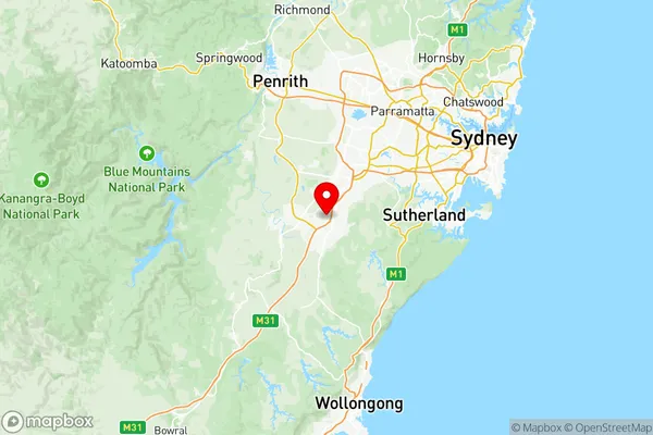
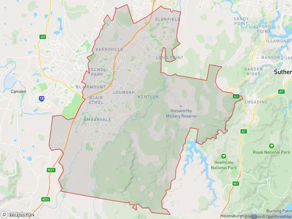
Campbelltown (NSW) Suburbs & Region, Campbelltown (NSW) Map & Postcodes
Campbelltown (NSW) Suburbs & Region, Campbelltown (NSW) Map & Postcodes in Campbelltown (NSW), Sydney Outer South West, NSW, AU
Campbelltown (NSW) Region
Region Name
Campbelltown (NSW) (NSW, AU)Campbelltown (NSW) Area
333.01 square kilometers (333.01 ㎢)Postal Codes
1890, 2167, 2558, 2559, and from 2563 to 2567 (In total, there are 9 postcodes in Campbelltown (NSW).)Campbelltown (NSW) Introduction
Campbelltown is a suburb of Sydney, located in the state of New South Wales, Australia. It is situated in the Macarthur region and is part of the South West Sydney region. Campbelltown is approximately 30 kilometers southwest of Sydney's central business district and is bordered by the suburbs of Camden, Liverpool, and Narellan. The suburb has a rich history and was originally settled by the Campbelltown Aboriginal people. It was named after John Campbell, who was a Scottish settler and landowner in the area. Campbelltown is known for its diverse population and has a mix of residential, commercial, and industrial areas. The suburb has a number of popular attractions, including the Campbelltown Arts Centre, which hosts a variety of cultural events and exhibitions. There are also several parks and recreational facilities, including the Campbelltown Showground and the Campbelltown Sports Complex. Campbelltown is well-connected to the rest of Sydney, with excellent public transport links. The suburb is served by the Campbelltown railway station, which is located on the Main South line, and by several bus routes. In terms of economy, Campbelltown is a thriving business hub. The suburb is home to a number of major companies, including Toyota, Boeing, and Airbus. There is also a significant retail sector, with a number of shopping centers and supermarkets. Overall, Campbelltown is a vibrant and diverse suburb with a lot to offer its residents and visitorsAustralia State
City or Big Region
District or Regional Area
Campbelltown (NSW) Region Map

Campbelltown (NSW) Postcodes / Zip Codes
Campbelltown (NSW) Suburbs
Claymore Eagle Vale Raby
Holsworthy Military Area
Leumeah Minto Heights
Macquarie Fields Glenfield
Rosemeadow Glen Alpine
Campbelltown (NSW) full address
Campbelltown (NSW), Sydney Outer South West, New South Wales, NSW, Australia, SaCode: 12302Country
Campbelltown (NSW), Sydney Outer South West, New South Wales, NSW, Australia, SaCode: 12302
Campbelltown (NSW) Suburbs & Region, Campbelltown (NSW) Map & Postcodes has 9 areas or regions above, and there are 29 Campbelltown (NSW) suburbs below. The sa3code for the Campbelltown (NSW) region is 12302. Its latitude and longitude coordinates are -34.0369,150.811.
Campbelltown (NSW) Suburbs & Localities
1. Ingleburn
2. Glenfield
3. Claymore
4. Blairmount
5. Glenquarie
6. Ingleburn
7. Macquarie Links
8. Bow Bowing
9. Minto
10. Eagle Vale
11. Kearns
12. Macquarie Fields
13. Bardia
14. Eschol Park
15. Menangle Park
16. Long Point
17. Denham Court
18. Minto Dc
19. Minto Heights
20. St Andrews
21. Varroville
22. Narellan
24. Narellan Vale
25. Smeaton Grange
26. Currans Hill
27. Harrington Park
28. Mount Annan
29. Narellan Dc
